
IMAGES TAKEN NEAR TO
Hillside Park, NEWTOWNARDS, BT23 5SN
Introduction
This page details the photographs taken nearby to Hillside Park, BT23 5SN by members of the Geograph project.
The Geograph project started in 2005 with the aim of publishing, organising and preserving representative images for every square kilometre of Great Britain, Ireland and the Isle of Man.

There are currently over 7.5m images from over14,400 individuals and you can help contribute to the project by visiting https://www.geograph.org.uk
Image Map
Images are licensed for reuse under creativecommons.org/licenses/by-sa/2.0
Notes
- Clicking on the map will re-center to the selected point.
- The higher the marker number, the further away the image location is from the centre of the postcode.
Image Listing (206 Images Found)
Images are licensed for reuse under creativecommons.org/licenses/by-sa/2.0
Image
Details
Distance
1
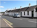
Painters at work on cottages in the High Street, Comber
Image: © Eric Jones
Taken: 2 Aug 2013
0.05 miles
2
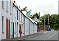
Cottages, Comber (2013-1)
The cottages, stretching uphill towards Ballygowan.
Image: © Albert Bridge
Taken: 21 Aug 2013
0.06 miles
3
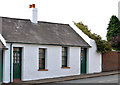
Cottages, Comber (2013-2)
The two at the south western end of the row. Looking at the chimneys it’s clear that they were built with only one fire in each cottage.
Image: © Albert Bridge
Taken: 21 Aug 2013
0.06 miles
4
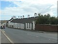
Terraced cottages, High Street, Comber
The roof line stays the same as the lower buildings gain an extra floor.
Image: © Christine Johnstone
Taken: 19 Apr 2024
0.06 miles
5
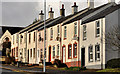
High Street, Comber (2)
See Image The view in the other direction – towards Ballygowan. The houses (right) are to a standard design but seem particularly suited to the hill. Note the different roof levels to accommodate the gradient. This church Image and Image is on the left.
Image: © Albert Bridge
Taken: 10 Mar 2012
0.06 miles
6
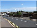
The High Street descending towards The Square at Comber
Image: © Eric Jones
Taken: 2 Aug 2013
0.06 miles
7
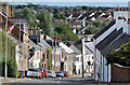
High Street, Comber (2013)
Comber sits, at close to sea level, amidst the drumlins of north Down – something which is easily forgotten especially when arriving from the Newtownards direction. This view, looking down High Street, towards The Square, shows the sloping street with the drumlins, now covered by houses, in the background. Image shows the view in the other direction.
Image: © Albert Bridge
Taken: 21 Aug 2013
0.07 miles
8
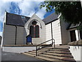
Comber First Presbyterian Church from the east
The First Comber Presbyterian Church dates from 1645. Initially it worshiped at what today is St Mary's Church of Ireland but with the changing political scene its minister James Gordon was ejected and replaced by a more conforming minister, William Dowdell. The Presbyterian faction of the congregation then formed their own church which was established here on what was then the outskirts of Comber, but not before its women members attacked the new vicar and stripped him of his vestments.
Image: © Eric Jones
Taken: 2 Aug 2013
0.08 miles
9
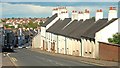
Cottages, Comber (2009)
The view, inward, down the hill towards the town.
Image: © Albert Bridge
Taken: 9 May 2009
0.08 miles
10

Corner protector, Comber
One of a pair of corner protectors located on business premises at High Street in Comber. Covered by layers of paint, the foundry inscription is unreadable but the style is very similar to the one seen in Image
Image: © Rossographer
Taken: 6 Jul 2011
0.08 miles