
IMAGES TAKEN NEAR TO
The Mews, Killinchy Street, NEWTOWNARDS, BT23 5RW
Introduction
This page details the photographs taken nearby to The Mews, Killinchy Street, BT23 5RW by members of the Geograph project.
The Geograph project started in 2005 with the aim of publishing, organising and preserving representative images for every square kilometre of Great Britain, Ireland and the Isle of Man.

There are currently over 7.5m images from over14,400 individuals and you can help contribute to the project by visiting https://www.geograph.org.uk
Image Map
Images are licensed for reuse under creativecommons.org/licenses/by-sa/2.0
Notes
- Clicking on the map will re-center to the selected point.
- The higher the marker number, the further away the image location is from the centre of the postcode.
Image Listing (231 Images Found)
Images are licensed for reuse under creativecommons.org/licenses/by-sa/2.0
Image
Details
Distance
1
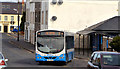
Bus, Comber (March 2014)
An Ulsterbus Wrightbus-bodied Scania (420 UEZ 2420) departing Killinchy Street with the 09.30 Shrigley Image – Belfast Laganside Buscentre. Since the closure of the bus station Image inward services from Shrigley now go into The Square and back out to this stop Image in Killinchy Street. After calling they continue to the roundabout Image before returning back along the street and thence to Belfast.
Image: © Albert Bridge
Taken: 17 Mar 2014
0.01 miles
2
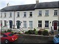
Neo-Georgian terraces housing in Killinchy Street, Comber
Image: © Eric Jones
Taken: 17 Apr 2017
0.01 miles
3
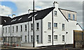
Hamilton Court, Comber (April 2016)
The completed and occupied housing association apartments on the old bus station site, Killinchy Street. The bus shelter (lower left) provides a common reference point.
Image: © Albert Bridge
Taken: 19 Apr 2016
0.02 miles
4
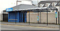
Former bus station, Comber
The former Ulsterbus station at Killinchy Street. Passengers now use the shelter (right). See also Image (March 2006). Continue to Image (August 2013).
Image: © Albert Bridge
Taken: 26 Apr 2013
0.02 miles
5
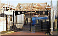
The bus station site, Comber - January 2015(2)
New social housing under construction at the Killinchy end of the former bus station.
Image: © Albert Bridge
Taken: 3 Jan 2015
0.02 miles
6
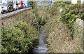
The Glen River, Comber (April 2016)
Mainly hidden from view, as it flows behind houses and business premises, the Glen River http://www.geograph.org.uk/search.php?i=62469988, looking upstream from Killinchy Street. Not shown on the Google map.
Image: © Albert Bridge
Taken: 19 Apr 2016
0.02 miles
7

Killinchy Street, Comber
Killinchy Street in Comber close to the town centre.
Image: © Rossographer
Taken: 10 May 2025
0.02 miles
8
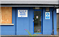
Former bus station, Comber (2)
See Image (April 2013). The closed bus station seen through the Killinchy Street car park fence.
Image: © Albert Bridge
Taken: 10 Aug 2013
0.02 miles
9
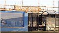
The bus station site, Comber - January 2015(1)
New social housing under construction at the town end of the former bus station.
Image: © Albert Bridge
Taken: 3 Jan 2015
0.02 miles
10
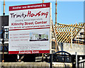
The bus station site, Comber - January 2015(3)
The Trinity Housing Association board facing Killinchy Street. This photograph appears as a matter of record only. I have no connection with anyone involved in the construction or letting of the properties.
Image: © Albert Bridge
Taken: 3 Jan 2015
0.02 miles