
IMAGES TAKEN NEAR TO
Londonderry Hill, NEWTOWNARDS, BT23 5EY
Introduction
This page details the photographs taken nearby to Londonderry Hill, BT23 5EY by members of the Geograph project.
The Geograph project started in 2005 with the aim of publishing, organising and preserving representative images for every square kilometre of Great Britain, Ireland and the Isle of Man.

There are currently over 7.5m images from over14,400 individuals and you can help contribute to the project by visiting https://www.geograph.org.uk
Image Map
Images are licensed for reuse under creativecommons.org/licenses/by-sa/2.0
Notes
- Clicking on the map will re-center to the selected point.
- The higher the marker number, the further away the image location is from the centre of the postcode.
Image Listing (40 Images Found)
Images are licensed for reuse under creativecommons.org/licenses/by-sa/2.0
Image
Details
Distance
1
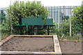
Times past in Comber
A fairly good representation of the small 4-4-2 tank locos which were the main motive power of the Belfast & County Down Railway. My great-uncle worked for the railway as a passenger train guard and would have been familiar with these engines and with Comber station as he travelled up and down the line. The green is maybe a bit lighter than the Brunswick green livery the original sported but it makes a nice addition to the scene and is located near the fire station just off the Comber by-pass and about where the platform once stood. The by-pass is just behind the fence.
Image: © Robert Ashby
Taken: 13 Apr 2016
0.08 miles
2
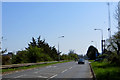
Comber Bypass
This was approximately where Comber railway station was located. The communications mast stands where the goods yard was. The only surviving building from the railway era is the former goods shed located just behind the trees beside the mast and not visible from this position and which is, as far as I know, used by the Northern Ireland Fire and Rescue Service.
Image: © Robert Ashby
Taken: 22 Apr 2015
0.12 miles
3
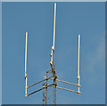
Mast, Comber fire station (2)
Part of the communications mast at Comber fire station Image
Image: © Albert Bridge
Taken: 21 Aug 2013
0.12 miles
4
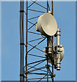
Mast, Comber fire station (1)
Part of the communications mast at Comber fire station Image
Image: © Albert Bridge
Taken: 21 Aug 2013
0.12 miles
5
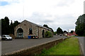
A relic from the railway
The old B.C.D.R.goods shed at the site of the former Comber Station now used by the N.I. Fire And Rescue Service. The railway closed in 1950 and this is one of the few remaining structures to survive intact. Got an attractive facelift sometime along the way into the bargain.
Image: © Robert Ashby
Taken: 8 Jul 2015
0.13 miles
6
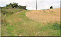
Barley field, Comber
A barley field on the western side of the bypass.
Image: © Albert Bridge
Taken: 21 Aug 2013
0.15 miles
7
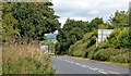
The Comber bypass (2013-3)
The view towards Belfast from just past the Glen Link. In common with most of the first phase of the road, the landscaping, planted more than 50 years ago, has done what it was meant to do. In this case it’s almost hiding the direction sign (middle right).
Image: © Albert Bridge
Taken: 21 Aug 2013
0.15 miles
8
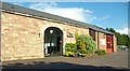
Comber fire station
Comber fire station occupies the old Belfast and County Down Railway goods shed – suitably modernised and extended.
Image: © Albert Bridge
Taken: 9 May 2009
0.15 miles
9
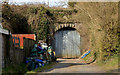
Former railway arch, Comber
An arch, under what was the railway to Donaghadee and Downpatrick/Newcastle, on the western side of the Belfast Road, before the site of Comber station Image The bypass was built on the course of the line Image
Image: © Albert Bridge
Taken: 6 Apr 2013
0.16 miles
10
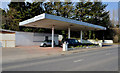
Former petrol station, Comber
See Image The former petrol station on the same site.
Image: © Albert Bridge
Taken: 6 Apr 2013
0.16 miles