IMAGES TAKEN NEAR TO
Park Crescent, NEWTOWNARDS, BT23 5AS

Introduction

This page details the photographs taken nearby to Park Crescent, BT23 5AS by members of the Geograph project.

The Geograph project started in 2005 with the aim of publishing, organising and preserving representative images for every square kilometre of Great Britain, Ireland and the Isle of Man.

There are currently over 7.5m images from over14,400 individuals and you can help contribute to the project by visiting https://www.geograph.org.uk

Image Map


Images are licensed for reuse under creativecommons.org/licenses/by-sa/2.0
Notes
  • Clicking on the map will re-center to the selected point.
  • The higher the marker number, the further away the image location is from the centre of the postcode.

Image Listing (209 Images Found)

Images are licensed for reuse under creativecommons.org/licenses/by-sa/2.0
  • ...
Image
Details
Distance
1
The Comber River downstream of the A21 bridge
Image: © Eric Jones Taken: 22 Apr 2017
0.03 miles
2
Flood wall below houses in Newtown Green
On the north bank of the Comber River.
Image: © Christine Johnstone Taken: 19 Apr 2024
0.04 miles
3
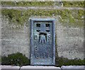
Flush Bracket, Comber
Flush bracket on the north western tip of St Mary's Church of Ireland in Comber Image The number on the bracket is OSNIBM 3117. The mark is 7.25 metres above MSL. A flush bracket is a type of bench mark set onto the face of a building. See also http://www.geograph.org.uk/search.php?i=11037856 for many other examples I have found.
Image: © Rossographer Taken: 27 Mar 2010
0.06 miles
4
Vacant development site, Comber
Part of a large development site, which has been offered for sale for a number of years, at 1 Newtownards Road. The agents’ description includes “Prime commercial/residential development site occupying a prominent position c. 3.36 acres (1.36 hectares) with outline planning consent for residential development. . . . . The site is ideally suited to the development of retail warehousing, residential, car showrooms or business units, subject to planning”. This petrol station Image is at middle right. The Enler River Image is just out of picture to the left. This photograph appears as a matter of geographical and historical record only. I have no connection with any of the parties involved in the sale.
Image: © Albert Bridge Taken: 23 Oct 2013
0.06 miles
5
Park Crescent, Comber
Social housing (bungalows) near Killinchy Street.
Image: © Albert Bridge Taken: 17 Mar 2014
0.06 miles
6
East elevation, St Mary's Church, Comber
A Church of Ireland church.
Image: © Christine Johnstone Taken: 19 Apr 2024
0.06 miles
7
Gravestone, Comber
Gravestone at St Mary's Church of Ireland, Comber Image "Here lyeth the body of Gillbert Kennedy of Castell Beeg who departed this life 3rd day of March 1699 aged 76 years" Kennedy is a Scottish name, I wonder if he arrived here with the early 17th century plantations. Castlebeg is a small townland north of Comber.
Image: © Rossographer Taken: 5 Mar 2022
0.06 miles
8
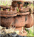
Old water main, Comber (January 2015)
See Image (April 2013). The inscription on the side “G&C [Guest & Chrimes] 80 PNT 8 3 AV”.
Image: © Albert Bridge Taken: 3 Jan 2015
0.07 miles
9
St Mary's CoI, Comber
Built in 1840, the present St Mary's Church occupies the site of a plain 1623 church and an earlier Cistercian abbey (St.Mary's, 1199) which was totally destroyed in 1572. In 1798, its rector, Rev. Robert Mortimer, was killed in the Battle of Saintfield by rebellious Presbyterian United Irishmen whilst accompanying the Newtownards Yeomanry, leaving behind a widow and nine orphans.
Image: © Eric Jones Taken: 2 Aug 2013
0.07 miles
10
The Comber River (5)
The Comber River, swollen after recent rain, immediately downstream of Image
Image: © Albert Bridge Taken: 4 Jan 2012
0.07 miles
  • ...