
IMAGES TAKEN NEAR TO
Ballyrainey Road, NEWTOWNARDS, BT23 4SP
Introduction
This page details the photographs taken nearby to Ballyrainey Road, BT23 4SP by members of the Geograph project.
The Geograph project started in 2005 with the aim of publishing, organising and preserving representative images for every square kilometre of Great Britain, Ireland and the Isle of Man.

There are currently over 7.5m images from over14,400 individuals and you can help contribute to the project by visiting https://www.geograph.org.uk
Image Map
Images are licensed for reuse under creativecommons.org/licenses/by-sa/2.0
Notes
- Clicking on the map will re-center to the selected point.
- The higher the marker number, the further away the image location is from the centre of the postcode.
Image Listing (10 Images Found)
Images are licensed for reuse under creativecommons.org/licenses/by-sa/2.0
Image
Details
Distance
1
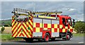
Fire appliances near Newtownards - July 2015 (1)
One of three appliances in attendance at a road traffic accident on the eastbound lanes of this part of the Kempe Stones Road Image
See also Image
and Image
Image: © Albert Bridge
Taken: 31 Jul 2015
0.07 miles
2
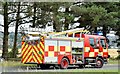
Fire appliances near Newtownards - July 2015 (3)
See Image One of three appliances in attendance at a road traffic accident on the eastbound lanes of this part of the Kempe Stones Road Image
Image: © Albert Bridge
Taken: 31 Jul 2015
0.08 miles
3
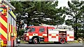
Fire appliances near Newtownards - July 2015 (2)
See Image Two of the three appliances in attendance at a road traffic accident on the eastbound lanes of this part of the Kempe Stones Road Image Continue to Image
Image: © Albert Bridge
Taken: 31 Jul 2015
0.08 miles
4
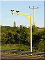
Say cheese!
Road cameras on the A20, with the monument on Scrabo Hill looking on too.
Image: © Ian Paterson
Taken: 24 May 2010
0.11 miles
5
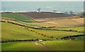
Drumlin country (19)
A passing cloud casts its shadow over the drumlins to the west/north west of Scrabo. Belfast lies beyond.
Image: © Albert Bridge
Taken: 3 Apr 2008
0.15 miles
6
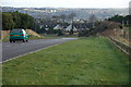
The Belfast - Newtownards road (1)
The Belfast-Newtownards road originally ran in an almost straight line and involved quite steep gradients. It was replaced by a new (but twisting) road, to the north, over Bradshaw’s Brae – most likely to make matters easier for the mail coaches. The present road (on the line of the first road) opened in the late 1970’s. This is the eastbound carriageway on the descent to Newtownards. There is an unusually wide central reservation here, possibly to accommodate a junction with a ring road which was never built. See also Image
Image: © Albert Bridge
Taken: 21 Jan 2007
0.17 miles
7
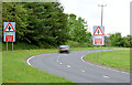
"Crossroads" signs, Newtownards
Two crossroads signs, slightly further away from the junction than usual, on the Kempe Stones Road, on the Dundonald side of here Image This is a stretch of dual carriageway where the lanes are separated by a wide central reservation – explained in Image
Image: © Albert Bridge
Taken: 10 Jun 2014
0.18 miles
8
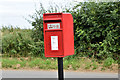
Pressed-steel postbox (BT23 401), Ballycullen, Newtownards (August 2016)
Post-mounted pressed-steel postbox (BT23 401) on the Milecross Road
Image: © Albert Bridge
Taken: 6 Aug 2016
0.20 miles
9

Fields near Ballyrainey Road
View from the roadside.
Image: © Ian Paterson
Taken: 24 May 2010
0.21 miles
10

"Road junction" sign near Newtownards
Sign (slightly out of the vertical) on the Kempe Stones Road (the Belfast road), approaching Newtownards. The road to the left is the Milecross Road – a minor road running to the (old) Belfast Road.
Image: © Albert Bridge
Taken: 16 May 2010
0.23 miles