
IMAGES TAKEN NEAR TO
Blenheim Drive, NEWTOWNARDS, BT23 4RB
Introduction
This page details the photographs taken nearby to Blenheim Drive, BT23 4RB by members of the Geograph project.
The Geograph project started in 2005 with the aim of publishing, organising and preserving representative images for every square kilometre of Great Britain, Ireland and the Isle of Man.

There are currently over 7.5m images from over14,400 individuals and you can help contribute to the project by visiting https://www.geograph.org.uk
Image Map
Images are licensed for reuse under creativecommons.org/licenses/by-sa/2.0
Notes
- Clicking on the map will re-center to the selected point.
- The higher the marker number, the further away the image location is from the centre of the postcode.
Image Listing (25 Images Found)
Images are licensed for reuse under creativecommons.org/licenses/by-sa/2.0
Image
Details
Distance
1
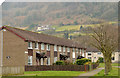
Blenheim Drive, Newtownards (March 2014)
See Image (December 2013). The northern end seen from the footpath to the Messines Road. Image shows a similar view with the rich colours of spring on show.
Image: © Albert Bridge
Taken: 26 Mar 2014
0.06 miles
2
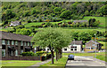
Blenheim Drive, Newtownards (May 2014)
See Image A similar view but with the rich colours of spring on show.
Image: © Albert Bridge
Taken: 12 May 2014
0.06 miles
3
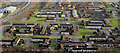
The West Winds, Newtownards (2)
See Image The part of the estate to the north of that in the previous photo.
Image: © Albert Bridge
Taken: 16 Jan 2010
0.07 miles
4
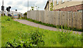
Footpath and cycle path, West Winds, Newtownards
A combined footpath and cycle path leading from Blenheim Drive Image and Dakota Avenue to the Messines Road Image (background).
Image: © Albert Bridge
Taken: 12 May 2014
0.10 miles
5
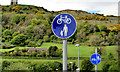
Footpath and cycle path signs, West Winds, Newtownards
Two signs on the Messines Road Image The one nearest the camera indicates that this path Image is a combined footpath and cycle path. The other shows that they have separate lanes beside the road.
Image: © Albert Bridge
Taken: 12 May 2014
0.11 miles
6
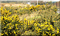
Whin bushes, Newtownards
Whin bushes, on a large tract of undeveloped land close to the Jubilee Business Park, beside the Jubilee Road.
Image: © Albert Bridge
Taken: 26 Mar 2014
0.14 miles
7
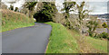
The Scrabo Road, Newtownards
The Scrabo Road is a minor road running south from Newtownards, roughly parallel to the Comber Road. This view, inward to the town, is on the climb towards Scrabo Tower.
Image: © Albert Bridge
Taken: 26 Apr 2013
0.15 miles
8
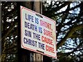
Religious message, Newtownards
Religious message by the Scrabo Road, below Scrabo Tower Image
Image: © Albert Bridge
Taken: 26 Apr 2013
0.15 miles
9
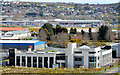
Sketrick House, Newtownards
An office building, on the Jubilee Road, part of the Ards Business Centre http://www.ardsbusiness.com/. This view is from the Scrabo Road Image
Image: © Albert Bridge
Taken: 26 Apr 2013
0.16 miles
10
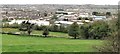
Business Units at the Scrabo Business Park, Newtownards
The park is located alongside the A20 on the south-western periphery of Newtownards.
Image: © Eric Jones
Taken: 22 Apr 2017
0.17 miles