
IMAGES TAKEN NEAR TO
Comber Road, NEWTOWNARDS, BT23 4QS
Introduction
This page details the photographs taken nearby to Comber Road, BT23 4QS by members of the Geograph project.
The Geograph project started in 2005 with the aim of publishing, organising and preserving representative images for every square kilometre of Great Britain, Ireland and the Isle of Man.

There are currently over 7.5m images from over14,400 individuals and you can help contribute to the project by visiting https://www.geograph.org.uk
Image Map
Images are licensed for reuse under creativecommons.org/licenses/by-sa/2.0
Notes
- Clicking on the map will re-center to the selected point.
- The higher the marker number, the further away the image location is from the centre of the postcode.
Image Listing (8 Images Found)
Images are licensed for reuse under creativecommons.org/licenses/by-sa/2.0
Image
Details
Distance
1
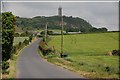
The Moate Road, Newtownards (2)
Image: © Albert Bridge
Taken: 21 Jun 2007
0.05 miles
2

Farm track near Scrabo, Newtownards
This track runs off the Moat Road near Newtownards Image
Image: © Albert Bridge
Taken: 21 Jun 2007
0.05 miles
3
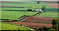
The view from Scrabo Tower, Newtownards (1)
Looking approximately south east towards Castleaverry townland and the Newtownards – Comber road. The old Belfast and County Down railway once ran across the fields here but all traces seen to have vanished under the plough.
Image: © Albert Bridge
Taken: 24 May 2010
0.07 miles
4

The view from Scrabo Tower, Newtownards (5)
Down the path from the Tower, looking past the Scrabo Road (the crossroads is just out of picture to the right) to the Newtownards – Comber road and the loughshore.
Image: © Albert Bridge
Taken: 24 May 2010
0.13 miles
5

Sheughs draining coastal flatlands between the A21 and Moat Road
The hill on the right is Scrabo Hill.
Image: © Eric Jones
Taken: 22 Apr 2017
0.16 miles
6
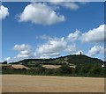
Arable farmland to the lee of Scrabo Hill
Image: © Eric Jones
Taken: 30 Aug 2017
0.16 miles
7
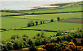
The view from Scrabo Tower, Newtownards (2)
The view, from below the Tower, looking across the sloping and then flat countryside, to the shore of Strangford Lough. The Newtownards – Comber road runs across the upper part of the photo. A track, leading to a waste water treatment works, can be seen running close to the loughshore, just above the road.
Image: © Albert Bridge
Taken: 24 May 2010
0.24 miles
8
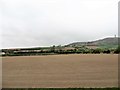
Arable land between the A21 and Scrabo Hill
This is potato growing country par excellence.
Image: © Eric Jones
Taken: 22 Apr 2017
0.25 miles