
IMAGES TAKEN NEAR TO
Shimna Close, NEWTOWNARDS, BT23 4PE
Introduction
This page details the photographs taken nearby to Shimna Close, BT23 4PE by members of the Geograph project.
The Geograph project started in 2005 with the aim of publishing, organising and preserving representative images for every square kilometre of Great Britain, Ireland and the Isle of Man.

There are currently over 7.5m images from over14,400 individuals and you can help contribute to the project by visiting https://www.geograph.org.uk
Image Map
Images are licensed for reuse under creativecommons.org/licenses/by-sa/2.0
Notes
- Clicking on the map will re-center to the selected point.
- The higher the marker number, the further away the image location is from the centre of the postcode.
Image Listing (37 Images Found)
Images are licensed for reuse under creativecommons.org/licenses/by-sa/2.0
Image
Details
Distance
1
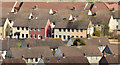
Rooftops, Newtownards (February 2015)
This path Image, as it climbs towards the South Quarry at Scrabo, gives good views over the rooftops towards the flat centre of Newtownards. The brightly-painted houses are at South Green.
Image: © Albert Bridge
Taken: 26 Feb 2015
0.08 miles
2
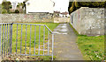
Footpath, Newtownards
A footpath leading from the Jubilee Road (behind me) to Ardmillan Crescent.
Image: © Albert Bridge
Taken: 26 Mar 2014
0.09 miles
3

New road, Newtownards (2)
See Image The section of new road, under construction at the rear of the businesses on the Jubilee Road. (The Google map shows the road already built).
Image: © Albert Bridge
Taken: 8 Jul 2008
0.12 miles
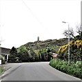
5
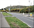
The A20 south of the Scrabo Road Roundabout
This is a new section of the Belfast to Portaferry road and follows the line of the abandoned BCDR track bed thus by passing the centre of Newtownards.
Image: © Eric Jones
Taken: 22 Apr 2017
0.13 miles
6

John Graham manhole cover, Newtownards
A John Graham http://www.geograph.org.uk/search.php?i=47865618 manhole cover set in the concrete road surface at Windsor Avenue. The address on the cover is Dromore but the company moved to Hillsborough earlier this century.
Image: © Albert Bridge
Taken: 26 Mar 2014
0.15 miles
7

Business Units at the Scrabo Business Park, Newtownards
The park is located alongside the A20 on the south-western periphery of Newtownards.
Image: © Eric Jones
Taken: 22 Apr 2017
0.15 miles
9

Sketrick House, Newtownards
An office building, on the Jubilee Road, part of the Ards Business Centre http://www.ardsbusiness.com/. This view is from the Scrabo Road Image
Image: © Albert Bridge
Taken: 26 Apr 2013
0.16 miles
10
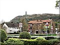
Scrabo Estate Community Resource Centre, Newtownards
Scrabo Estate, bordered by the Scrabo Road and Circular Road, is a post WWII housing development on the western fringe of Newtownards. The Community Resource centre run by the local Community Association is leased from the Northern Ireland Housing Executive. Scrabo Tower, on the skyline overlooks the estate.
Image: © Eric Jones
Taken: 22 Apr 2017
0.16 miles