
IMAGES TAKEN NEAR TO
Regent Street, NEWTOWNARDS, BT23 4LP
Introduction
This page details the photographs taken nearby to Regent Street, BT23 4LP by members of the Geograph project.
The Geograph project started in 2005 with the aim of publishing, organising and preserving representative images for every square kilometre of Great Britain, Ireland and the Isle of Man.

There are currently over 7.5m images from over14,400 individuals and you can help contribute to the project by visiting https://www.geograph.org.uk
Image Map
Images are licensed for reuse under creativecommons.org/licenses/by-sa/2.0
Notes
- Clicking on the map will re-center to the selected point.
- The higher the marker number, the further away the image location is from the centre of the postcode.
Image Listing (218 Images Found)
Images are licensed for reuse under creativecommons.org/licenses/by-sa/2.0
Image
Details
Distance
1
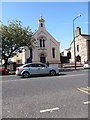
Regent Street Methodist Church, Newtownards
This church, of the Wesleyan persuasion, stands next to the Regent Street Presbyterian Church
Image: © Eric Jones
Taken: 21 May 2012
0.01 miles
2
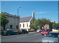
The Regent Street Presbyterian and Methodist Churches, Newtownards
Some 86% of Newtownards population of 28,000 are from a Protestant background.
Image: © Eric Jones
Taken: 22 May 2012
0.01 miles
3
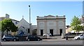
The Regent Street Presbyterian Church, Newtownards
Regent Street Presbyterian Church was formed as a split from First Newtownards Presbyterian Church in 1835.
Image: © Eric Jones
Taken: 21 May 2012
0.02 miles
4
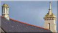
Roof detail, Newtownards Methodist church
The roof of Newtownards Methodist church (1854), Regent Street, features what seems to be an imitation lantern (left) and a finial on what might be a sham belfry.
Image: © Albert Bridge
Taken: 14 Sep 2013
0.02 miles
5
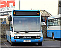
Optare Solo, Newtownards (January 2015)
An Ulsterbus Optare Solo (1918 – VOI 188) parked in the yard at Newtownards bus station Image The vehicle on the right is a Wright-bodied Volvo (396 – AFZ 1396).
Image: © Albert Bridge
Taken: 26 Jan 2015
0.02 miles
6
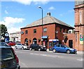
Newtownards Ulsterbus Station in Regent Street
The building contains passenger facilities, including a shop, and offices. Buses park at the back of the building and exit out into Regent Street next to where the red car is.
Image]
Image: © Eric Jones
Taken: 2 Aug 2013
0.03 miles
7
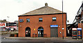
Bus station, Newtownards (1)
A modest structure in Regent Street. Served mainly by local services and buses to the Ards Peninsula and Comber. The Belfast services use Gibson’s Lane Image (behind me). The depot is off the Portaferry Road. Image shows the clock.
Image: © Albert Bridge
Taken: 19 Feb 2012
0.03 miles
9
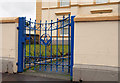
Masonic gate, Newtownards
The ornamental gate, in Regent Street, at the entrance to Newtownards Masonic Hall Image (background).
Image: © Albert Bridge
Taken: 7 Feb 2011
0.03 miles
10
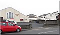
Methodist Community Centre and the Regent Street Presbyterian Church Community Centre in Mill Street
These are located behind the respective main church building which face on to Regent Street.
Image: © Eric Jones
Taken: 22 Apr 2017
0.03 miles