1
Pound Street, Newtownards
A rebuilt street, running from High Street (behind me) to John Street East.
Image: © Albert Bridge
Taken: 28 Jul 2011
0.04 miles
2
Jardine Terrace, Newtownards (2)
Image: © Albert Bridge
Taken: 12 Jun 2013
0.04 miles
3
Shopping Precinct behind South Street, Newtownards
Image: © Eric Jones
Taken: 22 Apr 2017
0.05 miles
4
Jardine Terrace, Newtownards (1)
A terrace of three houses, at the Mill Street end of Pound Street, built in 2004. Unusually for modern buildings there is a datestone – see
Image
Image: © Albert Bridge
Taken: 12 Jun 2013
0.05 miles
5
Old mill building behind the High Street at Newtownards
Image: © Eric Jones
Taken: 22 Apr 2017
0.05 miles
6
Newtownards PSNI Station
The Newtownards policing neighbourhood (what in previous times would be called a sub-division) covers the Ards and North Down area between Bangor and Portaferry and between Comber and Donaghadee. The brick building on the extreme right, also facing on to John Street is the Newtownards Ambulance Station.
Image: © Eric Jones
Taken: 22 Apr 2017
0.07 miles
7
'Molly Brown's', Newtownards
Bar and restaurant situated on South Street in Newtownards - see http://www.mollybrownsbar.com/ for further information.
Image: © Rossographer
Taken: 1 Apr 2010
0.07 miles
8
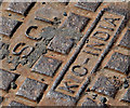
KIC Metaliks manhole cover, Newtownards (1)
A manhole cover, at the John Street end of John Street Lane, made by KIC Metaliks Limited http://www.kicmetaliks.com/ (formerly Kajaria Iron Casting Limited) of Durgapur http://en.wikipedia.org/wiki/Durgapur.
Image shows the maker’s name.
Image: © Albert Bridge
Taken: 13 May 2013
0.07 miles
9
KIC Metaliks manhole cover, Newtownards (2)
See
Image The maker’s name.
Image: © Albert Bridge
Taken: 13 May 2013
0.07 miles
10
Retention Systems socket cover, Newtownards (July 2016)
The socket is a clever and simple way of attaching street furniture (such as bins and seats) to the ground without using unsightly and semi-permanent holes and dollops of concrete. This link http://www.retention-system.com/ is to the maker’s website which includes the following description “Typically traffic signal posts, signposts, bollards and most street furniture items are installed encased in concrete, or anchored and bolted to a concrete plinth. This means they are permanent and removal entails further expensive, disruptive and potentially dangerous excavation. With the introduction of the multi-use RETENTION SYSTEM these and other posts can now be installed in high-strength RS sockets and replaced with great speed, ease and efficiency.”
This installation, at Conway Square, is part of an extensive programme of public realm improvements in the centre of Newtownards. I have no connection with any of the parties involved in the scheme.
Image: © Albert Bridge
Taken: 24 Jul 2016
0.08 miles


