
IMAGES TAKEN NEAR TO
South Street Mews, NEWTOWNARDS, BT23 4LB
Introduction
This page details the photographs taken nearby to South Street Mews, BT23 4LB by members of the Geograph project.
The Geograph project started in 2005 with the aim of publishing, organising and preserving representative images for every square kilometre of Great Britain, Ireland and the Isle of Man.

There are currently over 7.5m images from over14,400 individuals and you can help contribute to the project by visiting https://www.geograph.org.uk
Image Map
Images are licensed for reuse under creativecommons.org/licenses/by-sa/2.0
Notes
- Clicking on the map will re-center to the selected point.
- The higher the marker number, the further away the image location is from the centre of the postcode.
Image Listing (111 Images Found)
Images are licensed for reuse under creativecommons.org/licenses/by-sa/2.0
Image
Details
Distance
1
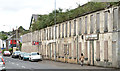
South Street, Newtownards (2013-1)
Derelict buildings on the eastern side of South Street, inward of the Carleton Bridge Image This should, by now, have been the Castlebawn development but the recession halted such grandiose ideas – something repeated in many towns throughout NI. Image shows the backs of some of the properties.
Image: © Albert Bridge
Taken: 12 Jun 2013
0.03 miles
2
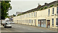
South Street, Newtownards (May 2015)
See Image (June 2013). The derelict façades, on the eastern side of South Street, hidden by disguises. The vegetation growing from the slateless roofs betrays the disguise. This is one of the best examples of the mad pre-recession property boom, funded by extravagant lending, now with little hope of any sort of medium-term redevelopment.
Image: © Albert Bridge
Taken: 15 May 2015
0.04 miles
3
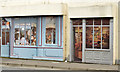
Disguised buildings, Newtownards (May 2015)
Disguised and derelict façades, on the eastern side of South Street Image
Image: © Albert Bridge
Taken: 15 May 2015
0.04 miles
4
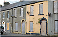
South Street, Newtownards (2013-2)
Two boarded-up houses at South Street (possibly nos 79 (left) and 77). The two on the left are undergoing a major renovation.
Image: © Albert Bridge
Taken: 12 Jun 2013
0.05 miles
5
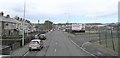
View North along South Street, Newtownards
Image: © Eric Jones
Taken: 17 Apr 2017
0.05 miles
6
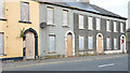
South Street, Newtownards (2013-3)
Four boarded-up houses at South Street (possibly 71 (right) – 77).
Image: © Albert Bridge
Taken: 12 Jun 2013
0.05 miles
7
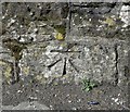
Bench Mark, Newtownards
Cut bench mark located on the western wall of the Carleton Bridge across the canal on South Street, Newtownards Image
The mark is 3.18 metres above MSL.
See also http://www.geograph.org.uk/search.php?i=11037856 for many other examples I have found.
Image: © Rossographer
Taken: 1 Apr 2010
0.05 miles
8
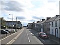
South Street south of the John Street/Court Street Crossroads
This is the road south towards Comber and on to Downpatrick. This is an area of Georgian and Victorian businesses and housing.
Image: © Eric Jones
Taken: 17 Apr 2017
0.05 miles
9
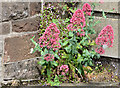
Valerian and toadflax, Newtownards
Red valerian http://www.habitas.org.uk/flora/species.asp?item=4346 and what seems to be ivy-leafed toadflax http://www.habitas.org.uk/flora/species.asp?item=4076 growing in wind-blown soil at the Carleton Bridge Image
Image: © Albert Bridge
Taken: 12 Jun 2013
0.06 miles
10
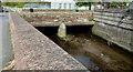
The Carleton Bridge, Newtownards
Now concrete with sandstone parapets, the Carleton Bridge carries South Street across the canal Image It also has this bench mark Image
Image: © Albert Bridge
Taken: 13 May 2013
0.06 miles