
IMAGES TAKEN NEAR TO
Lansdowne Crescent, NEWTOWNARDS, BT23 4GU
Introduction
This page details the photographs taken nearby to Lansdowne Crescent, BT23 4GU by members of the Geograph project.
The Geograph project started in 2005 with the aim of publishing, organising and preserving representative images for every square kilometre of Great Britain, Ireland and the Isle of Man.

There are currently over 7.5m images from over14,400 individuals and you can help contribute to the project by visiting https://www.geograph.org.uk
Image Map
Images are licensed for reuse under creativecommons.org/licenses/by-sa/2.0
Notes
- Clicking on the map will re-center to the selected point.
- The higher the marker number, the further away the image location is from the centre of the postcode.
Image Listing (7 Images Found)
Images are licensed for reuse under creativecommons.org/licenses/by-sa/2.0
Image
Details
Distance
1
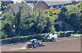
Old railway bridge, Newtownards (April 2015)
An underbridge, on the eastern side of the Scrabo Road, which once carried the Comber – Newtownards section of the line to Donaghadee. Not shown on the current 1:50,000 OS map and not visible in the satellite photograph but shown on the old one inch map. Subject position approximate.
Image: © Albert Bridge
Taken: 18 Apr 2015
0.10 miles
2
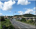
Lansdowne Road, Newtownards
Scrabo Hill forms the background.
Image: © Eric Jones
Taken: 30 Aug 2017
0.14 miles
3
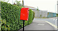
Postbox BT23 373, Newtownards (May 2015)
Post-mounted EIIR postbox (BT23 373) at Lansdowne Road/Ravenhill Lane. The street names (after rugby grounds) can be explained by the presence of Ards Rugby Club nearby.
Image: © Albert Bridge
Taken: 15 May 2015
0.16 miles
4
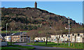
Blenheim Drive, Newtownards (2)
See Image Blenheim Drive from close to Dakota Avenue. Scrabo Tower and Hill dominate the background. Continue to Image
Image: © Albert Bridge
Taken: 16 Dec 2013
0.18 miles
5
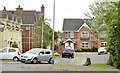
Ravenhill Lane, Newtownards (May 2015)
Houses off the Lansdowne Road. The stone (bottom right) records that the development was built in 2003. The street is named after Ravenhill rugby ground Image Image – Ards RFC is nearby.
Image: © Albert Bridge
Taken: 15 May 2015
0.18 miles
6
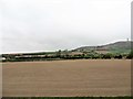
Arable land between the A21 and Scrabo Hill
This is potato growing country par excellence.
Image: © Eric Jones
Taken: 22 Apr 2017
0.22 miles
7
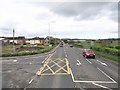
The Landsdowne Road junction on the A21
This side road marks the southern urban fringe of Newtownards.
Image: © Eric Jones
Taken: 17 Apr 2017
0.24 miles