
IMAGES TAKEN NEAR TO
Thomas Street, NEWTOWNARDS, BT23 4DR
Introduction
This page details the photographs taken nearby to Thomas Street, BT23 4DR by members of the Geograph project.
The Geograph project started in 2005 with the aim of publishing, organising and preserving representative images for every square kilometre of Great Britain, Ireland and the Isle of Man.

There are currently over 7.5m images from over14,400 individuals and you can help contribute to the project by visiting https://www.geograph.org.uk
Image Map
Images are licensed for reuse under creativecommons.org/licenses/by-sa/2.0
Notes
- Clicking on the map will re-center to the selected point.
- The higher the marker number, the further away the image location is from the centre of the postcode.
Image Listing (205 Images Found)
Images are licensed for reuse under creativecommons.org/licenses/by-sa/2.0
Image
Details
Distance
1
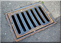
Gully grating, Newtownards
Grating from the Millfield Foundry in Belfast, this example is located on Thomas Street in Newtownards. One of many from the foundry seen in the town.
Image: © Rossographer
Taken: 1 Jun 2011
0.01 miles
2
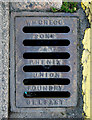
Gully grating, Newtownards
Gully grating located on Thomas Street in Newtownards. It is marked "Wm Gregg, Sons & Phenix, Union Foundry, Belfast." The company traded in the early 1900s from 15-17 Church Lane in Belfast Image and the proprietor, William Gregg, lived at Willowbank on the Antrim Road. One of several spotted in the town - see also Image
Image: © Rossographer
Taken: 1 Jun 2011
0.02 miles
3
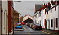
Robert Street, Newtownards
A very narrow street, running parallel to West Street, close to the back of the bus station. Wide enough to take a car but not a lorry.
Image: © Albert Bridge
Taken: 7 Feb 2011
0.03 miles
4
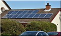
Solar panels, Newtownards (April 2016)
At Thomas Street.
Image: © Albert Bridge
Taken: 21 Apr 2016
0.03 miles
5

Bench Mark, Newtownards
Cut bench mark located on the south-western corner of Regent House on Regent Street, Newtownards.
The mark is 8.74 metres above MSL.
See also http://www.geograph.org.uk/search.php?i=11037856 for many other examples I have found.
Image: © Rossographer
Taken: 1 Apr 2010
0.04 miles
6

Regent House, Newtownards
Former house on Regent Street in Newtownards. It was constructed in 1820 as a home for the owner of a brewery in the town and later became home to Regent House School (the school is now located on Circular Road to the south of the town centre). One of the few examples of Greek Revival architecture in County Down it takes its name from the 'Prince Regent' who visited the town to open 'Regent Street' on which it stands. Latterly it had been used as a furniture showroom but is currently empty and to let.
Image: © Rossographer
Taken: 1 Apr 2010
0.04 miles
7
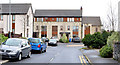
Mark Mews, Newtownards
A recent development of apartments on the eastern side of Thomas Street.
Image: © Albert Bridge
Taken: 5 Feb 2014
0.04 miles
8

View along West Street, Newtownards
The Georgian building in the centre ground is the Regents House Business Centre.
Image]
Image: © Eric Jones
Taken: 17 Apr 2017
0.05 miles
9
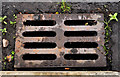
McKeown grating cover, Newtownards
See Image Another McKeown’s Grosvenor Foundry http://www.geograph.org.uk/search.php?i=23884431 grating but without the patent number. This one is at the Robert Street end of Brewery Lane.
Image: © Albert Bridge
Taken: 11 Aug 2011
0.05 miles
10

James Street, Newtownards
This is another mainly residential street behind the Central Business District.
Image: © Eric Jones
Taken: 21 May 2012
0.05 miles