
IMAGES TAKEN NEAR TO
North Street, NEWTOWNARDS, BT23 4DE
Introduction
This page details the photographs taken nearby to North Street, BT23 4DE by members of the Geograph project.
The Geograph project started in 2005 with the aim of publishing, organising and preserving representative images for every square kilometre of Great Britain, Ireland and the Isle of Man.

There are currently over 7.5m images from over14,400 individuals and you can help contribute to the project by visiting https://www.geograph.org.uk
Image Map
Images are licensed for reuse under creativecommons.org/licenses/by-sa/2.0
Notes
- Clicking on the map will re-center to the selected point.
- The higher the marker number, the further away the image location is from the centre of the postcode.
Image Listing (220 Images Found)
Images are licensed for reuse under creativecommons.org/licenses/by-sa/2.0
Image
Details
Distance
1
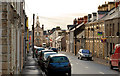
North Street, Newtownards
Newtownards was a planned Plantation town, laid out in the early part of the 17th century, on lands granted to Sir Hugh Montgomery Image Four of the streets are named after the points of the compass. This is North Street, looking towards Conway Square, from Orchard Place.
Image: © Albert Bridge
Taken: 7 Feb 2011
0.02 miles
2

The junction of North Street and East Street, Newtownards
Image: © Eric Jones
Taken: 21 May 2012
0.04 miles
3

Newtownards Town Hall
Built by the Marquis of Londonderry as a Market House (formerly a prison) from local Scrabo Stone in 1765. The Hall stands in the town centre on the north side of Conway Square.
Image: © Jonathan Billinger
Taken: 17 May 2007
0.04 miles
4

Ulster Bank
This three storey bank building opened in January 1926 on the site of an earlier bank, established in 1865. Listed, ungraded with details at: http://www.doeni.gov.uk/niea/content-databases-buildview?id=4210
Image: © Michael Dibb
Taken: 9 Jun 2015
0.04 miles
5

Strean Presbyterian Church and Vestry, Mary Street
This church was established in 1865.
Image: © Eric Jones
Taken: 21 May 2012
0.05 miles
6

Strean Presbyterian Church, Mary Street, Newtownards
This congregation was formed following a quarrel over the appointment of a new minister for the town's 1st Presbyterian Church. The unsuccessful faction left to form a church of their own, a not uncommon occurrence in Ulster Presbyterianism. The new church, opened in 1866, was bank rolled by Thomas Strean, a wealthy businessman of the town.
Image: © Eric Jones
Taken: 21 May 2012
0.05 miles
7

Strean Presbyterian Church, Mary Street, Newtownards
This congregation was formed following a quarrel over the appointment of the Rev Mr MacCauley as successor to the Rev Mr Julius McCulloch as new minister for the town's First Presbyterian Church. The unsuccessful faction left to form a church of their own, a not uncommon occurrence in the history of Ulster Presbyterianism. The new church, opened in 1866, was bank rolled by Thomas Strean, a wealthy businessman of the town.
Image: © Eric Jones
Taken: 22 Apr 2017
0.05 miles
8
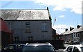
The Orange Hall of Newtownards District LOL No. 4 in Upper Mary Street
Amongst the lodges that use this hall is LOL 111 "Ulster's Chosen Few"
http://www.newtownardsorange.org.uk/111.htm
Image: © Eric Jones
Taken: 2 Aug 2013
0.05 miles
9
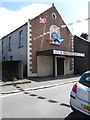
Newtownards Orange Hall
This is the home of Newtownards District Orange Lodge No. 4 - the governing body of some twelve private lodges who meet in the Orange Hall. The hall stands across the street from Newtownards 2nd Presbyterian Church.
http://www.newtownardsorange.org.uk/ourdistrict.htm
Image: © Eric Jones
Taken: 2 Aug 2013
0.05 miles
10

Strean Presbyterian Church, Newtownards
Strean Presbyterian Church has been in existence since 1865 when Thomas Strean provided the money for some local people to form a new congregation and build a centre for worship. See http://www.strean.org/default.aspx?menuID=1 for more information.
Image: © Rossographer
Taken: 29 Dec 2007
0.06 miles