
IMAGES TAKEN NEAR TO
Cooks Cove, NEWTOWNARDS, BT22 2ST
Introduction
This page details the photographs taken nearby to Cooks Cove, BT22 2ST by members of the Geograph project.
The Geograph project started in 2005 with the aim of publishing, organising and preserving representative images for every square kilometre of Great Britain, Ireland and the Isle of Man.

There are currently over 7.5m images from over14,400 individuals and you can help contribute to the project by visiting https://www.geograph.org.uk
Image Map
Images are licensed for reuse under creativecommons.org/licenses/by-sa/2.0
Notes
- Clicking on the map will re-center to the selected point.
- The higher the marker number, the further away the image location is from the centre of the postcode.
Image Listing (24 Images Found)
Images are licensed for reuse under creativecommons.org/licenses/by-sa/2.0
Image
Details
Distance
1
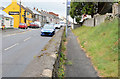
Cook's Brae, Kircubbin
Part of the main road between Belfast/Newtownards and Portaferry (behind me) where the road is below the level of the footpath. For something similar see Image
Image: © Albert Bridge
Taken: 25 Jul 2013
0.08 miles
2
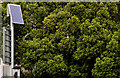
Solar panel, Kircubbin
One of two at Cook’s Brae – both of which power the flashing lights on “school” signs. This one is opposite Boyd Avenue.
Image: © Albert Bridge
Taken: 30 Aug 2011
0.08 miles
3
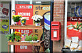
Letter box, Kircubbin
Wall-mounted EIIR letter box (BT22 660) at Kircubbin post office (inside a petrol station) at Cook’s Brae. The box and post office were previously at Main Street.
Image: © Albert Bridge
Taken: 25 Jul 2013
0.10 miles
4
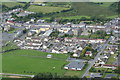
Kircubbin Village from the air
A Sunday afternoon helicopter ride over Kircubbin district.
Image: © Ronan Magee
Taken: 13 Jul 2008
0.11 miles
5
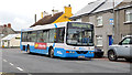
Bus, Kircubbin
An Ulsterbus Wright-bodied Volvo (2780 BCZ 2780) calling at the Main Street/Roden Street stop with the 09.55 Portaferry-Newtownards via Cloughey, Portavogie and Ballyhalbert.
Image: © Albert Bridge
Taken: 25 Jul 2013
0.11 miles
6
![Main Street, Kircubbin [1]](https://s2.geograph.org.uk/photos/73/84/738490_a3c2adcf_120x120.jpg)
Main Street, Kircubbin [1]
Looking south-east in the direction of Portaferry.
Image: © Rossographer
Taken: 25 Mar 2008
0.12 miles
7
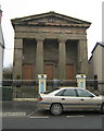
Holy Trinity Church, Kircubbin
Holy Trinity (Church of Ireland) in Main Street, Kircubbin. Built 1843 to a design by Charles Lanyon in the style of a greek temple.
Image: © Rossographer
Taken: 25 Mar 2008
0.13 miles
8
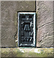
Flush Bracket, Kircubbin
Flush bracket located on the south-eastern tip of Holy Trinity Church, Kircubbin Image
The number on the bracket is OSBM 3477
The mark is 9.77 metres above MSL.
A flush bracket is a type of bench mark set onto the face of a building. See also http://www.geograph.org.uk/search.php?i=11037856 for many other examples I have found.
Image: © Rossographer
Taken: 8 Aug 2010
0.13 miles
9
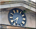
Church clock, Kircubbin
The clock (not working) on the pediment of this church Image at Main Street.
Image: © Albert Bridge
Taken: 25 Jul 2013
0.14 miles
10
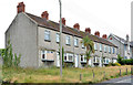
Vacant terrace, Kircubbin
A terrace of six vacant houses at Roden Street – possibly another relic from the era of the property boom before the recession. Note that each house has three chimneys.
Image: © Albert Bridge
Taken: 25 Jul 2013
0.14 miles