
IMAGES TAKEN NEAR TO
Meadow Park, NEWTOWNARDS, BT22 2SB
Introduction
This page details the photographs taken nearby to Meadow Park, BT22 2SB by members of the Geograph project.
The Geograph project started in 2005 with the aim of publishing, organising and preserving representative images for every square kilometre of Great Britain, Ireland and the Isle of Man.

There are currently over 7.5m images from over14,400 individuals and you can help contribute to the project by visiting https://www.geograph.org.uk
Image Map
Images are licensed for reuse under creativecommons.org/licenses/by-sa/2.0
Notes
- Clicking on the map will re-center to the selected point.
- The higher the marker number, the further away the image location is from the centre of the postcode.
Image Listing (13 Images Found)
Images are licensed for reuse under creativecommons.org/licenses/by-sa/2.0
Image
Details
Distance
1
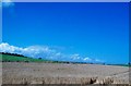
Cropland adjoining the seaside village of Ballywalter
Image: © Eric Jones
Taken: 2 Aug 2013
0.11 miles
3
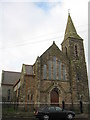
Ballywalter Presbyterian Church
Ballywalter Presbyterian Church on Main Street, this Victorian Gothic church was built in the 1890's. The first Presbyterian meeting-house was built around 1770 on a site near the present harbour. Forty-five years later the second was built at the corner of Well Road and Main Street, the site presently occupied by the Sandpiper Inn and a further church was built in Greyabbey Road.
Image: © Sue Adair
Taken: 8 Nov 2008
0.19 miles
5
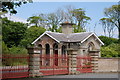
Gate Lodge, Ballywalter Park
The gate lodge at Ballywalter Park, just outside Ballywalter (also “Whitkirk”) on the road to Portavogie was built circa 1850 to the design of Charles Lanyon the celebrity architect of his era. Lanyon also designed a second lodge on the western side of the estate but this has since been demolished.
Image: © Albert Bridge
Taken: 4 Jun 2006
0.22 miles
6
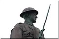
War memorial, Ballywalter (detail)
The war memorial in Ballywalter (also “Whitkirk”) is at the southern end of the Main Street and shows a soldier in WW1 uniform. Image shows the memorial in May 2012.
Image: © Albert Bridge
Taken: 21 Feb 2007
0.22 miles
7
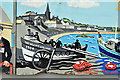
Mural, Ballywalter - August 2017(2)
See Image Part of the mural featuring the “William Wallace”, a 34ft self-righting pulling (rowing) lifeboat (ON 93) on station Image 1885/1906.
Image: © Albert Bridge
Taken: 18 Aug 2017
0.23 miles
8
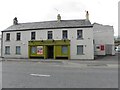
Dry Spout, Ballywalter
Pictured at Main Street
Image: © Kenneth Allen
Taken: 17 Apr 2012
0.23 miles
9
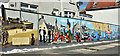
Mural, Ballywalter - August 2017(1)
A mural, facing Main Street, depicting scenes of local interest – past and recent. See also Image
Image: © Albert Bridge
Taken: 18 Aug 2017
0.23 miles
10
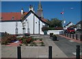
Public garden on the corner of Well Street and Main Street, Ballywalter
Image: © Eric Jones
Taken: 2 Aug 2013
0.23 miles