
IMAGES TAKEN NEAR TO
Springvale Road, NEWTOWNARDS, BT22 2PE
Introduction
This page details the photographs taken nearby to Springvale Road, BT22 2PE by members of the Geograph project.
The Geograph project started in 2005 with the aim of publishing, organising and preserving representative images for every square kilometre of Great Britain, Ireland and the Isle of Man.

There are currently over 7.5m images from over14,400 individuals and you can help contribute to the project by visiting https://www.geograph.org.uk
Image Map
Images are licensed for reuse under creativecommons.org/licenses/by-sa/2.0
Notes
- Clicking on the map will re-center to the selected point.
- The higher the marker number, the further away the image location is from the centre of the postcode.
Image Listing (21 Images Found)
Images are licensed for reuse under creativecommons.org/licenses/by-sa/2.0
Image
Details
Distance
1
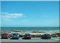
Parking Ground overlooking the Irish Sea
The parking ground on the south side of Ballywalter is located on Springvale Road.
Image: © Eric Jones
Taken: 2 Aug 2013
0.04 miles
2
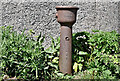
Old Glenfield drinking fountain, Ballywalter (May 2017)
An old Glenfield drinking fountain at the exit from the Springvale Road car park.
Image: © Albert Bridge
Taken: 19 May 2017
0.06 miles
3
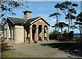
Gate Lodge, Ballywalter Park
Gate Lodge at the Springvale Road entrance to Ballywalter Park (see also Image). Designed, like the big house, by Charles Lanyon and built c1850.
See also http://www.geograph.org.uk/search.php?i=8075526 for some related images.
Image: © Rossographer
Taken: 12 Sep 2009
0.07 miles
4
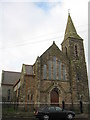
Ballywalter Presbyterian Church
Ballywalter Presbyterian Church on Main Street, this Victorian Gothic church was built in the 1890's. The first Presbyterian meeting-house was built around 1770 on a site near the present harbour. Forty-five years later the second was built at the corner of Well Road and Main Street, the site presently occupied by the Sandpiper Inn and a further church was built in Greyabbey Road.
Image: © Sue Adair
Taken: 8 Nov 2008
0.08 miles
5
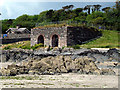
Lime Kiln, Ballywalter
Lime Kiln by the beach at the southern end of Ballywalter. Thought to date from c1851, lime was imported into the village on small sailing ships, possibly from the Dundalk area. It is thought that the kiln may have been built to supply mortar for the construction of the long wall around nearby Ballywalter Park.
Image: © Rossographer
Taken: 14 Jun 2009
0.09 miles
6
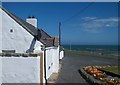
Cottage facing the Ballywalter War Memorial
Image: © Eric Jones
Taken: 2 Aug 2013
0.10 miles
7
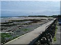
Shoreline south of Ballywalter
Looking towards 'The Long Sand' south of Ballywalter.
Image: © Rossographer
Taken: 17 May 2008
0.11 miles
8

Ballywalter war memorial (2012-2)
See Image The side view from the Main Street end of the Harbour Road.
Image: © Albert Bridge
Taken: 14 May 2012
0.12 miles
9
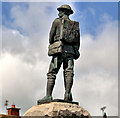
Ballywalter war memorial (2012-1)
See Image (February 2007). A rear view of the war memorial from the Harbour Road. Image shows the side view.
Image: © Albert Bridge
Taken: 14 May 2012
0.12 miles
10
![The Long Sand, Ballywalter [2]](https://s3.geograph.org.uk/photos/80/67/806707_e40bd9e5_120x120.jpg)
The Long Sand, Ballywalter [2]
Some rock outcrops at the northern end of 'The Long Sand', Ballywalter.
Image: © Rossographer
Taken: 17 May 2008
0.12 miles