
IMAGES TAKEN NEAR TO
Whitechurch Road, NEWTOWNARDS, BT22 2LB
Introduction
This page details the photographs taken nearby to Whitechurch Road, BT22 2LB by members of the Geograph project.
The Geograph project started in 2005 with the aim of publishing, organising and preserving representative images for every square kilometre of Great Britain, Ireland and the Isle of Man.

There are currently over 7.5m images from over14,400 individuals and you can help contribute to the project by visiting https://www.geograph.org.uk
Image Map
Images are licensed for reuse under creativecommons.org/licenses/by-sa/2.0
Notes
- Clicking on the map will re-center to the selected point.
- The higher the marker number, the further away the image location is from the centre of the postcode.
Image Listing (6 Images Found)
Images are licensed for reuse under creativecommons.org/licenses/by-sa/2.0
Image
Details
Distance
1
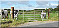
Field gate, Ballyferis near Ballywalter (August 2017)
A field gate, with metal posts, beside the Whitechurch Road, near the caravan site.
Image: © Albert Bridge
Taken: 18 Aug 2017
0.07 miles
2
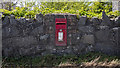
Postbox, Ganaway
Wall mounted Elizabeth II postbox (BT22 65) by the A2 Whitechurch Road at Ganaway.
Image: © Rossographer
Taken: 9 May 2020
0.11 miles
3
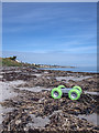
Beach, Ganaway
The beach at Ganaway (Ballyferris). Not particularly pleasant - strewn with broken bricks and a horrendous amount of plastic debris of which this toy was the largest.
Image: © Rossographer
Taken: 9 May 2020
0.11 miles
4
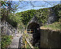
Bridge, Ganaway
Unseen from above, there is a tunnel under the A2 Whitechurch Road at Ganaway. As well as allowing a stream to flow into the sea, it allows access to the beach from Ganaway Activity Centre without the need for crossing the busy road.
Image: © Rossographer
Taken: 9 May 2020
0.13 miles
5
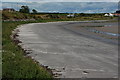
Ganaway Bay near Ballyferis (1)
Ganaway Bay is a good sandy beach spread over four squares. This is the view towards Ballywhiskin. For another view of the bay see Image
Image: © Albert Bridge
Taken: 28 Aug 2006
0.23 miles
6

The Whitechurch Road, Ganaway, Ballywalter (July 2015)
The Whitechurch Road, part of the coast road from Donaghadee to Portavogie and Cloughey, looking towards Millisle, at the end of the Ganaway Road. The Irish Sea is just east of the fields on the right.
Image: © Albert Bridge
Taken: 24 Jul 2015
0.23 miles