
IMAGES TAKEN NEAR TO
Drumfad Road, NEWTOWNARDS, BT22 2JA
Introduction
This page details the photographs taken nearby to Drumfad Road, BT22 2JA by members of the Geograph project.
The Geograph project started in 2005 with the aim of publishing, organising and preserving representative images for every square kilometre of Great Britain, Ireland and the Isle of Man.

There are currently over 7.5m images from over14,400 individuals and you can help contribute to the project by visiting https://www.geograph.org.uk
Image Map
Images are licensed for reuse under creativecommons.org/licenses/by-sa/2.0
Notes
- Clicking on the map will re-center to the selected point.
- The higher the marker number, the further away the image location is from the centre of the postcode.
Image Listing (16 Images Found)
Images are licensed for reuse under creativecommons.org/licenses/by-sa/2.0
Image
Details
Distance
1
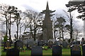
Christ Church, Carrowdore
Christ Church, Carrowdore stands at the end of a long lane off the Woburn Road. It is on a low hill close to Carrowdore Castle. It was built in 1863.
Image: © Albert Bridge
Taken: 12 Jan 2007
0.03 miles
2
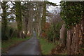
Lane, Christ Church, Carrowdore
See Image This is the lane leading from the church to the Woburn Road.
Image: © Albert Bridge
Taken: 12 Jan 2007
0.03 miles
3
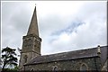
Christ Church, Carrowdore (2)
See Image This is the tower and spire.
Image: © Albert Bridge
Taken: 18 May 2007
0.03 miles
4
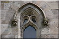
Christ Church, Carrowdore (3)
See Image This is one of the windows with two unidentified heads.
Image: © Albert Bridge
Taken: 18 May 2007
0.03 miles
5
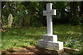
Grave, Christ Church, Carrowdore
See Image This cross marks the grave of two members of one of the local “Big House” families.
Image: © Albert Bridge
Taken: 18 May 2007
0.03 miles
6
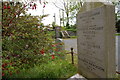
The grave of Louis Macneice near Carrowdore
Image: © Albert Bridge
Taken: 18 May 2007
0.03 miles
7
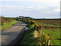
Drumfad Road near Carrowdore
Looking south east.
Image: © Rossographer
Taken: 24 Feb 2008
0.05 miles
8
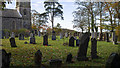
Christ Church, Carrowdore
Churchyard at Christ Church, Carrowdore. A wonderfully peaceful site on a low hill outside the village. See also Image
Image: © Rossographer
Taken: 2 Nov 2019
0.12 miles
9
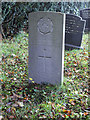
Gravestone, Carrowdore
WW1 war grave at Christ Church, Carrowdore.
"Hugh Andrew McKee enlisted in Donaghadee and he served with the Army Service Corps. Driver Hugh McKee (No. T4/123760) was 46 when he died of pneumonia on 27 October 1915 in the Second Northern General Hospital in Leeds and he was buried in Carrowdore (Christ Church) Churchyard, Co Down."
[from https://barryniblock.co.uk/world-war-one-list-of-dead/names-listed-alphabetically-by-surname/mcgilton-to-mckeown/mckee-hugh-andrew-no-t4123760/ accessed 11/11/2019]
Image: © Rossographer
Taken: 2 Nov 2019
0.13 miles
10

Towards Christ Church, Carrowdore
Christ Church sits on a hill beyond - the uniform piles of earth in the foreground are holes dug for tree planting (with thanks to SMcC for the explanation).
Image: © Rossographer
Taken: 24 Feb 2008
0.16 miles