IMAGES TAKEN NEAR TO
Ballyblack Road East, NEWTOWNARDS, BT22 2BD

Introduction

This page details the photographs taken nearby to Ballyblack Road East, BT22 2BD by members of the Geograph project.

The Geograph project started in 2005 with the aim of publishing, organising and preserving representative images for every square kilometre of Great Britain, Ireland and the Isle of Man.

There are currently over 7.5m images from over14,400 individuals and you can help contribute to the project by visiting https://www.geograph.org.uk

Image Map


Images are licensed for reuse under creativecommons.org/licenses/by-sa/2.0
Notes
  • Clicking on the map will re-center to the selected point.
  • The higher the marker number, the further away the image location is from the centre of the postcode.

Image Listing (10 Images Found)

Images are licensed for reuse under creativecommons.org/licenses/by-sa/2.0
Image
Details
Distance
1
Ballyblack Road
Heading south-east to Carrowdore
Image: © Kenneth Allen Taken: 17 Apr 2012
0.05 miles
2
Ballyblack Road East
Image: © Eric Jones Taken: 22 May 2012
0.10 miles
3
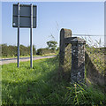
GPO Cable Marker near Carrowdore
What I assume is an old GPO cable marker at the Ballyblack crossroads near Carrowdore Image - I have only encountered one other before at Image so clarifications are welcome. It is marked 'GPO' at the top, similar to Image Possibly this is a "street pillar" - see http://www.britishtelephones.com/gpo/pillar.htm .
Image: © Rossographer Taken: 25 Aug 2019
0.13 miles
4
"Stop" sign, Ballyblack, Carrowdore (June 2015)
A “stop” sign, on a yellow sighting board, on the Grangee Road Image, at the Ballyblack Road/Ballyblack Road East crossroads.
Image: © Albert Bridge Taken: 24 Jun 2015
0.13 miles
5
National Cycle Network sign, Ballyblack near Carrowdore - June 2015(2)
A National Cycle Network Route 99 sign at the south western end of the Grangee Road Image
Image: © Albert Bridge Taken: 24 Jun 2015
0.14 miles
6
Crossroads, Ballyblack
Heading north-east
Image: © Kenneth Allen Taken: 17 Apr 2012
0.14 miles
7
Name sign, Grangee Road near Carrowdore (June 2015)
The name sign at the south western end of the Grangee Road, in Ballyblack townland, north west of Carrowdore. The road is part of National Cycle Network Route 99 (sign Image at upper right) through the low drumlins of the northern Ards Peninsula. The “Place-Names of Northern Ireland” records several changes in the spelling over the since years “Ballinegrangee” in 1605. The name is said to mean “townland of the grange”.
Image: © Albert Bridge Taken: 24 Jun 2015
0.14 miles
8
The Ballyblack Road East near Carrowdore (June 2015)
An undulating minor road running north west from Carrowdore. This view is towards Bangor from the corner of the Ballyblack Road, opposite the Grangee Road Image
Image: © Albert Bridge Taken: 24 Jun 2015
0.19 miles
9
Ballyboley Road
Heading north-west at Ballyboley
Image: © Kenneth Allen Taken: 17 Apr 2012
0.21 miles
10
Fields near Carrowdore
Farmland west of Carrowdore.
Image: © Rossographer Taken: 25 Apr 2020
0.24 miles