
IMAGES TAKEN NEAR TO
Portaferry Road, NEWTOWNARDS, BT22 2AJ
Introduction
This page details the photographs taken nearby to Portaferry Road, BT22 2AJ by members of the Geograph project.
The Geograph project started in 2005 with the aim of publishing, organising and preserving representative images for every square kilometre of Great Britain, Ireland and the Isle of Man.

There are currently over 7.5m images from over14,400 individuals and you can help contribute to the project by visiting https://www.geograph.org.uk
Image Map
Images are licensed for reuse under creativecommons.org/licenses/by-sa/2.0
Notes
- Clicking on the map will re-center to the selected point.
- The higher the marker number, the further away the image location is from the centre of the postcode.
Image Listing (13 Images Found)
Images are licensed for reuse under creativecommons.org/licenses/by-sa/2.0
Image
Details
Distance
1

Farm at Cunningburn
A farm just off the Poartferry Road at Cunningburn south of Newtownards.
Image: © Rossographer
Taken: 13 Apr 2008
0.01 miles
2

The Portaferry Road near Newtownards
The Newtownards – Portaferry road follows the eastern shore of Strangford Lough from Newtownards to south of Greyabbey. This section is at Cunningburn with Newtownards Sailing Club on the left. The road always seems disproportionately busy as far as Greyabbey.
Image: © Albert Bridge
Taken: 2 Aug 2010
0.10 miles
3

Toadflax, Cunningburn near Newtownards
Part of an extensive growth of toadflax, on a stone wall, beside the Portaferry Road Image, near the entrance to the sailing club.
Image: © Albert Bridge
Taken: 11 Jun 2012
0.12 miles
4

Cunningburn Jetty
At the north end of Strangford Lough, this area is popular with windsurfers - when the tide is in!
Image: © Michael Parry
Taken: 15 Apr 2005
0.12 miles
5

Jetty, Newtownards Sailing Club
A jetty at Newtownards Sailing Club http://www.newtownardssailingclub.co.uk/index.htm at Cunningburn off the Portaferry Road south of Newtownards.
Image: © Rossographer
Taken: 13 Apr 2008
0.13 miles
6

Cunningburn Road
This road which primarily provides access to farms runs inland from the Portaferry Road.
Image: © Eric Jones
Taken: 2 Aug 2013
0.13 miles
7
![Portaferry Road at Cunningburn [2]](https://s2.geograph.org.uk/photos/76/29/762950_2e0b85be_120x120.jpg)
Portaferry Road at Cunningburn [2]
Looking in the direction of Newtownards.
Image: © Rossographer
Taken: 13 Apr 2008
0.14 miles

9
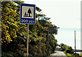
"Picnic area" sign near Newtownards (1)
Old style “picnic area” sign, on a blue background Image, still in use on the Portaferry Road between Newtownards and Greyabbey. The current sign is similar but brown. See also Image
Image: © Albert Bridge
Taken: 2 Aug 2010
0.17 miles
10

Sailing, Strangford Lough
Training the juniors near Newtownards Sailing Club.
Image: © Albert Bridge
Taken: 2 Aug 2010
0.19 miles