IMAGES TAKEN NEAR TO
Tides Bank, NEWTOWNARDS, BT22 1SG
Introduction
This page details the photographs taken nearby to Tides Bank, BT22 1SG by members of the Geograph project.
The Geograph project started in 2005 with the aim of publishing, organising and preserving representative images for every square kilometre of Great Britain, Ireland and the Isle of Man.

There are currently over 7.5m images from over14,400 individuals and you can help contribute to the project by visiting https://www.geograph.org.uk
Image Map
Images are licensed for reuse under creativecommons.org/licenses/by-sa/2.0
Notes
- Clicking on the map will re-center to the selected point.
- The higher the marker number, the further away the image location is from the centre of the postcode.
Image Listing (24 Images Found)
Images are licensed for reuse under creativecommons.org/licenses/by-sa/2.0
Image
Details
Distance
1
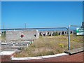
Uncompleted estate of semis and town houses at Portavogie
Very little work has been done on this site since 2008. The images taken by Google Street View at that time showed machinery on the site. The houses were advertised on a hoarding then as being Exclusive Development of Semi-detached and Town Houses.
Image: © Eric Jones
Taken: 2 Aug 2013
0.16 miles
2
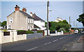
Harbour Road, Portavogie
Harbour Road in the village of Portavogie on the eastern Ards peninsula.
Image: © Rossographer
Taken: 8 Aug 2010
0.17 miles
3
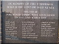
Plaque, Fishermens' Memorial
Plaque on the Fishermens' Memorial at Portavogie Harbour, there are six Adairs named, my husband's ancestors having come from this area.
Image: © Sue Adair
Taken: 23 Mar 2011
0.17 miles
4
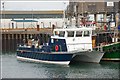
Catamaran at Portavogie harbour
An unidentified catamaran at Portavogie harbour.
Image: © Albert Bridge
Taken: 22 Oct 2007
0.19 miles
6
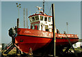
The "Michael McLoughlin" at Portavogie
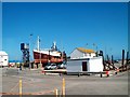
The tug “Michael McLoughlin” undergoing maintenance at Portavogie. Previously seen as the “Maura” Image Image and as the “Samson” Image Image
Image: © Albert Bridge
Taken: 27 Oct 2005
0.21 miles
7
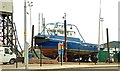
The "Farset" at Portavogie
See Image The tug “Farset” in the boatyard at Portavogie harbour.
Image: © Albert Bridge
Taken: 9 Jun 2008
0.21 miles
8
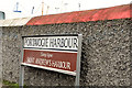
Portavogie harbour sign, Portavogie
A sign, on the Harbour Road, showing the harbour’s original name used by the Scots who settled in the Ards Peninsula. My understanding is that Portavogie was settled in the 17th century by families, from south western Scotland, who had a tradition of fishing. The harbour was a much later development.
Image: © Albert Bridge
Taken: 24 Oct 2012
0.21 miles