
IMAGES TAKEN NEAR TO
Seahill, DONAGHADEE, BT21 0SH
Introduction
This page details the photographs taken nearby to Seahill, BT21 0SH by members of the Geograph project.
The Geograph project started in 2005 with the aim of publishing, organising and preserving representative images for every square kilometre of Great Britain, Ireland and the Isle of Man.

There are currently over 7.5m images from over14,400 individuals and you can help contribute to the project by visiting https://www.geograph.org.uk
Image Map
Images are licensed for reuse under creativecommons.org/licenses/by-sa/2.0
Notes
- Clicking on the map will re-center to the selected point.
- The higher the marker number, the further away the image location is from the centre of the postcode.
Image Listing (31 Images Found)
Images are licensed for reuse under creativecommons.org/licenses/by-sa/2.0
Image
Details
Distance
1
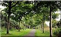
Railway path, Donaghadee (3)
See Image The view, along the path, towards Donaghadee, to the south west of the previous photograph. Continue to Image
Image: © Albert Bridge
Taken: 12 Aug 2011
0.03 miles
2
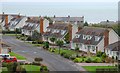
Suburban Donaghadee
Some fairly recent housing in Donaghadee seen from near the old water tower Image This part of Donaghadee would not be visible from any of the through-routes. The Irish Sea is in the background.
Image: © Albert Bridge
Taken: 7 Nov 2007
0.06 miles
3
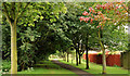
Railway path, Donaghadee (2)
See Image The view in the other direction (towards Newtownards) from close to the Millisle Road. Continue to Image
Image: © Albert Bridge
Taken: 12 Aug 2011
0.09 miles
4
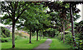
Railway path, Donaghadee (4)
See Image The view, along the path, towards Donaghadee, to the south west of the previous photograph. Continue to Image
Image: © Albert Bridge
Taken: 12 Aug 2011
0.10 miles
5
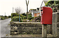
Letter box, Donaghadee
Post-mounted EIIR letter box, on the Millisle Road, opposite The Commons.
Image: © Albert Bridge
Taken: 26 Nov 2011
0.14 miles
6
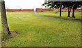
Railway path, Donaghadee (1)
Part of the trackbed of the old Belfast and County Down railway, to the south west of Donaghadee, is now a public path. Not immediately recognisable as “course of old rly” this is the start of the path, at the Millisle Road. The site of former Millisle Road halt Image and overbridge is just out of picture, at top left. Continue to Image
Image: © Albert Bridge
Taken: 12 Aug 2011
0.14 miles
7
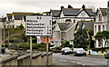
Route confirmatory sign, Donaghadee
A route confirmatory sign, on the Millisle Road, showing five destinations in the Ards Peninsula. The A2 is NI’s longest road. It runs, along or close to the coast, from Londonderry to Newry via Belfast and includes Image, Image and Image
Image: © Albert Bridge
Taken: 26 Nov 2011
0.15 miles
8
![Disused water tower, Donaghadee [2]](https://s2.geograph.org.uk/photos/73/99/739954_0eb14eff_120x120.jpg)
Disused water tower, Donaghadee [2]
A close up view of the old water tower in Donaghadee.
Image: © Rossographer
Taken: 26 Mar 2008
0.15 miles
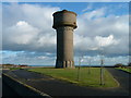
10
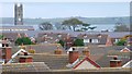
Donaghadee rooftops
The view across some of Donaghadee’s rooftops from near the old water tower Image The tower of the parish church Image can be seen at top left. Copeland Island and the Copeland Sound are in the background.
Image: © Albert Bridge
Taken: 7 Nov 2007
0.16 miles