
IMAGES TAKEN NEAR TO
Erindee Avenue, DONAGHADEE, BT21 0NE
Introduction
This page details the photographs taken nearby to Erindee Avenue, BT21 0NE by members of the Geograph project.
The Geograph project started in 2005 with the aim of publishing, organising and preserving representative images for every square kilometre of Great Britain, Ireland and the Isle of Man.

There are currently over 7.5m images from over14,400 individuals and you can help contribute to the project by visiting https://www.geograph.org.uk
Image Map
Images are licensed for reuse under creativecommons.org/licenses/by-sa/2.0
Notes
- Clicking on the map will re-center to the selected point.
- The higher the marker number, the further away the image location is from the centre of the postcode.
Image Listing (32 Images Found)
Images are licensed for reuse under creativecommons.org/licenses/by-sa/2.0
Image
Details
Distance
1
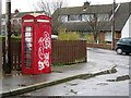
Old telephone box, Donaghadee
Old red K6 telephone call box / payphone just off the Killaughey Road.
Image: © Rossographer
Taken: 26 Mar 2008
0.07 miles
2
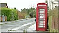
"K6" telephone box, Donaghadee (February 2016)
See Image (March 2008). The same “K6” telephone box (with telephone) from the other side of the Killaughey Road.
Image: © Albert Bridge
Taken: 4 Feb 2016
0.08 miles
3
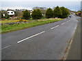
Killaughey Road, Donaghadee
Looking along the Killaughey Road from the edge of Donaghadee.
Image: © Rossographer
Taken: 26 Mar 2008
0.12 miles
4
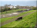
Park by the water tower, Donaghadee
The little public park by the old water tower in Donaghadee.
Image: © Rossographer
Taken: 26 Mar 2008
0.13 miles
5
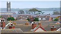
Donaghadee rooftops
The view across some of Donaghadee’s rooftops from near the old water tower Image The tower of the parish church Image can be seen at top left. Copeland Island and the Copeland Sound are in the background.
Image: © Albert Bridge
Taken: 7 Nov 2007
0.13 miles
7
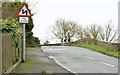
"Double bends" sign, Donaghadee (February 2016)
A “double bends” sign, for outward traffic, approaching the old railway bridge Image on the Killaughey Road.
Image: © Albert Bridge
Taken: 4 Feb 2016
0.15 miles
9
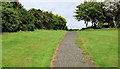
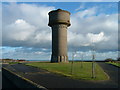
Path, Donaghadee
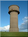
The path along the old railway Image, after it diverges from the course of the old line Image, on the south western side of the water tower Image
Image: © Albert Bridge
Taken: 12 Aug 2011
0.16 miles
10
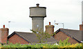
Old water tower, Donaghadee (3)
The old water tower, rising above the rooftops of Cypress Park, seen from the Killaughey Road.
Image: © Albert Bridge
Taken: 16 Jun 2013
0.16 miles