IMAGES TAKEN NEAR TO
Copeland Square, DONAGHADEE, BT21 0JZ
Introduction
This page details the photographs taken nearby to Copeland Square, BT21 0JZ by members of the Geograph project.
The Geograph project started in 2005 with the aim of publishing, organising and preserving representative images for every square kilometre of Great Britain, Ireland and the Isle of Man.

There are currently over 7.5m images from over14,400 individuals and you can help contribute to the project by visiting https://www.geograph.org.uk
Image Map
Images are licensed for reuse under creativecommons.org/licenses/by-sa/2.0
Notes
- Clicking on the map will re-center to the selected point.
- The higher the marker number, the further away the image location is from the centre of the postcode.
Image Listing (5 Images Found)
Images are licensed for reuse under creativecommons.org/licenses/by-sa/2.0
Image
Details
Distance
1
![Ballyvester Cemetery, Donaghadee [3]](https://s2.geograph.org.uk/photos/73/99/739946_6bc98f31_120x120.jpg)
Ballyvester Cemetery, Donaghadee [3]
Looking across some of the graves in the cemetery.
Image: © Rossographer
Taken: 26 Mar 2008
0.19 miles
2
![Ballyvester Cemetery, Donaghadee [2]](https://s3.geograph.org.uk/photos/73/99/739943_ecdf9ab7_120x120.jpg)
Ballyvester Cemetery, Donaghadee [2]
Looking south over the cemetery.
Image: © Rossographer
Taken: 26 Mar 2008
0.21 miles
3
![Ballyvester Cemetery, Donaghadee [1]](https://s0.geograph.org.uk/photos/73/99/739940_f0ce45c5_120x120.jpg)
Ballyvester Cemetery, Donaghadee [1]
Cemetery on southern edge of Donaghadee.
Image: © Rossographer
Taken: 26 Mar 2008
0.22 miles
4
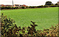
Field, Donaghadee
Image: © Albert Bridge
Taken: 12 Aug 2011
0.23 miles
5
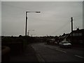
Between Ballyvester and Donaghadee
Image: © christian family
Taken: 26 Oct 2007
0.23 miles