
IMAGES TAKEN NEAR TO
High Street, DONAGHADEE, BT21 0HA
Introduction
This page details the photographs taken nearby to High Street, BT21 0HA by members of the Geograph project.
The Geograph project started in 2005 with the aim of publishing, organising and preserving representative images for every square kilometre of Great Britain, Ireland and the Isle of Man.

There are currently over 7.5m images from over14,400 individuals and you can help contribute to the project by visiting https://www.geograph.org.uk
Image Map
Images are licensed for reuse under creativecommons.org/licenses/by-sa/2.0
Notes
- Clicking on the map will re-center to the selected point.
- The higher the marker number, the further away the image location is from the centre of the postcode.
Image Listing (238 Images Found)
Images are licensed for reuse under creativecommons.org/licenses/by-sa/2.0
Image
Details
Distance
1
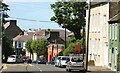
High Street, Donaghadee
The road in from the Millisle and Ballywalter directions. This is the view down towards New Street Image
Image: © Albert Bridge
Taken: 23 Jun 2009
0.00 miles
2
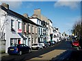
High Street, Donaghadee
Image: © Rossographer
Taken: 1 Apr 2010
0.01 miles
3
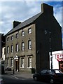
The old Town Hall, Donaghadee
The old and now redundant Town Hall in Donaghadee. Located in High Street this fine old building is now derelict and could be improved greatly by a sympathetic renovation.
Image: © Rossographer
Taken: 21 Aug 2008
0.02 miles
4
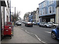
Former shops at the south-eastern end of the High Street, Donaghadee
Image: © Eric Jones
Taken: 28 Mar 2017
0.02 miles
5
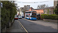
Bus, Donaghadee
Ulsterbus EEZ 2889 operating a number 7 service from Belfast to Millisle via Newtownards and Donaghadee. Taken during the Coronavirus pandemic, public transport in Northern Ireland was still running but on a greatly reduced service. There appeared to be no passengers onboard and the driver was wearing a face mask.
Image: © Rossographer
Taken: 9 Apr 2020
0.02 miles
6
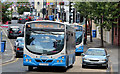
Two buses, Donaghadee (2013)
Two Ulsterbus Wright-bodied Scanias at the southern end of High Street, near Manor Street. The first is 480 (BFZ 8480) working the 10.35 Belfast (Laganside Buscentre) – Ballywalter. The second is 440 (UEZ 2440) which was not in service and turned off, right, along the Killaughey Road.
Image: © Albert Bridge
Taken: 7 Aug 2013
0.02 miles
7
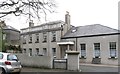
Manor Court, Donaghadee
This is part of a complex of historic buildings centred on the Manor House. The Manor House was built by the ancestors of Field Marshall Montgomery.
Image: © Eric Jones
Taken: 28 Mar 2017
0.03 miles
8

Pillar box, Donaghadee
EIIR pillar box, in High Street, opposite the post office and close to Image (at the lorry in the middle background).
Image: © Albert Bridge
Taken: 13 May 2011
0.03 miles
9

Bench Mark, Donaghadee
Cut bench mark located on the wall outside Donaghadee Masonic Hall on the corner of High Street and the Killaughey Road.
The mark is 13.10 metres above MSL.
See also http://www.geograph.org.uk/search.php?i=11037856 for many other examples I have found.
Image: © Rossographer
Taken: 1 Apr 2010
0.04 miles
10

Letter box, Donaghadee
Wall-mounted EIIR letter box on the Killaughey Road (High Street end).
Image: © Albert Bridge
Taken: 3 Mar 2011
0.04 miles