IMAGES TAKEN NEAR TO
Parade Mews, DONAGHADEE, BT21 0FJ

Introduction

This page details the photographs taken nearby to Parade Mews, BT21 0FJ by members of the Geograph project.

The Geograph project started in 2005 with the aim of publishing, organising and preserving representative images for every square kilometre of Great Britain, Ireland and the Isle of Man.

There are currently over 7.5m images from over14,400 individuals and you can help contribute to the project by visiting https://www.geograph.org.uk

Image Map


Images are licensed for reuse under creativecommons.org/licenses/by-sa/2.0
Notes
  • Clicking on the map will re-center to the selected point.
  • The higher the marker number, the further away the image location is from the centre of the postcode.

Image Listing (307 Images Found)

Images are licensed for reuse under creativecommons.org/licenses/by-sa/2.0
  • ...
Image
Details
Distance
1
The Moat, Donaghadee
The Moat was constructed to house the explosives used during the construction of Donaghadee Harbour and dates back to 1818. It was built on the site of a Norman Motte & Bailey from which it got its name The Moat. Now part of a park it gives commanding views over the town and out to the Copeland Islands a few miles off-shore
Image: © Robert Ashby Taken: 9 May 2009
0.00 miles
2
Inspection cover, Donaghadee
Anonymous rectangular cover, in Town Hall Lane, bearing only the words “INSPECTION COVER”.
Image: © Albert Bridge Taken: 26 Jun 2011
0.01 miles
3
Town Hall Lane, Donaghadee (2)
Approximately half-way, looking towards The Parade.
Image: © Albert Bridge Taken: 26 Jun 2011
0.01 miles
4
Town Hall Lane, Donaghadee (3)
The north eastern end, looking towards The Parade and the harbour.
Image: © Albert Bridge Taken: 26 Jun 2011
0.02 miles
5
Town Hall Lane, Donaghadee (1)
Town Hall Lane, looking from High Street to the Parade. It was formerly called “Murder Lane” and has a sign saying so. The origin of that name is not known. The only reference I can find is to the murder of a Mrs. McCready on 22 May 1852. Further information welcomed.
Image: © Albert Bridge Taken: 19 Feb 2008
0.02 miles
6
Donaghadee - The Parade
Image: © Colin Park Taken: 11 Sep 2023
0.02 miles
7
The Ulster Bank, Donaghadee - November 2014(1)
See Image (August 2013). During the week the Ulster Bank announced another round of branch closures (in addition to those in 2013 Image) to take effect in February 2015. Donaghadee is one of the listed branches. Accounts will be transferred to Bangor Image
Image: © Albert Bridge Taken: 29 Nov 2014
0.02 miles
8
The Ulster Bank, Donaghadee - November 2014(2)
See Image (August 2013). During the week the Ulster Bank announced another round of branch closures (in addition to those in 2013 Image) to take effect in February 2015. Donaghadee is one of the listed branches. The sign above the entrance. The logo is that of the Royal Bank of Scotland Image which has owned the bank since 2000. Before that (since 1917 it was part of the Westminster/National Westminster group). The Ulster’s coat of arms can be seen in Image
Image: © Albert Bridge Taken: 29 Nov 2014
0.02 miles
9
The Ulster Bank, Donaghadee - November 2014(3)
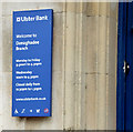
See Image (August 2013). During the week the Ulster Bank announced another round of branch closures (in addition to those in 2013 Image) to take effect in February 2015. Donaghadee is one of the listed branches. The information sign at the entrance. In years to come, when banking is all done “on-line”, people will consider this as old fashioned as a car’s starting handle. For a post-closure view continue to Image
Image: © Albert Bridge Taken: 29 Nov 2014
0.02 miles
10
The former Ulster Bank, Donaghadee (August 2016)
See Image The former Ulster Bank, 30 New Street, now with a “for sale” sign. The agents’ description includes “Character Listed traditional bank building. Extending to approximately 2,690 sqft (249.92 sqm). Suitable for a variety of uses, subject to any necessary consents.” I have no connection with any of the parties involved in the sale.
Image: © Albert Bridge Taken: 7 Aug 2016
0.03 miles
  • ...