
IMAGES TAKEN NEAR TO
Ashbrooke, DONAGHADEE, BT21 0EY
Introduction
This page details the photographs taken nearby to Ashbrooke, BT21 0EY by members of the Geograph project.
The Geograph project started in 2005 with the aim of publishing, organising and preserving representative images for every square kilometre of Great Britain, Ireland and the Isle of Man.

There are currently over 7.5m images from over14,400 individuals and you can help contribute to the project by visiting https://www.geograph.org.uk
Image Map
Images are licensed for reuse under creativecommons.org/licenses/by-sa/2.0
Notes
- Clicking on the map will re-center to the selected point.
- The higher the marker number, the further away the image location is from the centre of the postcode.
Image Listing (28 Images Found)
Images are licensed for reuse under creativecommons.org/licenses/by-sa/2.0
Image
Details
Distance
1
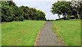
Path, Donaghadee
The path along the old railway Image, after it diverges from the course of the old line Image, on the south western side of the water tower Image
Image: © Albert Bridge
Taken: 12 Aug 2011
0.02 miles
2
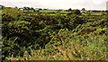
Old railway, Donaghadee (5)
See Image The old cutting - further west.
Image: © Albert Bridge
Taken: 12 Aug 2011
0.03 miles
3
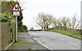
"Double bends" sign, Donaghadee (February 2016)
A “double bends” sign, for outward traffic, approaching the old railway bridge Image on the Killaughey Road.
Image: © Albert Bridge
Taken: 4 Feb 2016
0.04 miles
4
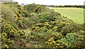
Course of old railway, Donaghadee - February 2016(2)
See Image In contrast to the previous photograph, the course of the old railway, looking towards Donaghadee, is still clearly discernible in this cutting, now overgrown with whin bushes.
Image: © Albert Bridge
Taken: 4 Feb 2016
0.05 miles
5

The Killaughey Road, Donaghadee
The Killaughey Road on the outskirts of Donaghadee at the former railway bridge. The Union flag and Ulster Banner https://en.wikipedia.org/wiki/Flag_of_Northern_Ireland are flying from the speed limit signs.
Image: © Rossographer
Taken: 8 Aug 2025
0.06 miles
6
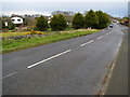
Killaughey Road, Donaghadee
Looking along the Killaughey Road from the edge of Donaghadee.
Image: © Rossographer
Taken: 26 Mar 2008
0.06 miles
7
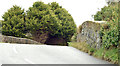
Old railway bridge, Killaughey Road, Donaghadee (February 2016)
See Image The view, inward, across the old bridge over the former Belfast and County Down Railway. Previously seen, from a completely different viewpoint, in March 2008 Image
Image: © Albert Bridge
Taken: 4 Feb 2016
0.06 miles
8
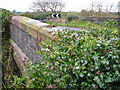
Old railway bridge, Donaghadee
The bridge on the Killaughey Road over the old railway seen in Image
Image: © Rossographer
Taken: 26 Mar 2008
0.07 miles
9
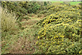
Course of old railway, Donaghadee - February 2016(1)
Now some 66 years since closure, the former Belfast and County Down Railway, looking towards Comber and Belfast, from this bridge Image on the Killaughey Road. For a comparison see Image (March 2008).
Image: © Albert Bridge
Taken: 4 Feb 2016
0.08 miles
10
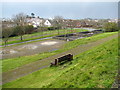
Park by the water tower, Donaghadee
The little public park by the old water tower in Donaghadee.
Image: © Rossographer
Taken: 26 Mar 2008
0.08 miles