
IMAGES TAKEN NEAR TO
Barnagh Park, DONAGHADEE, BT21 0AN
Introduction
This page details the photographs taken nearby to Barnagh Park, BT21 0AN by members of the Geograph project.
The Geograph project started in 2005 with the aim of publishing, organising and preserving representative images for every square kilometre of Great Britain, Ireland and the Isle of Man.

There are currently over 7.5m images from over14,400 individuals and you can help contribute to the project by visiting https://www.geograph.org.uk
Image Map
Images are licensed for reuse under creativecommons.org/licenses/by-sa/2.0
Notes
- Clicking on the map will re-center to the selected point.
- The higher the marker number, the further away the image location is from the centre of the postcode.
Image Listing (93 Images Found)
Images are licensed for reuse under creativecommons.org/licenses/by-sa/2.0
Image
Details
Distance
1
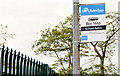
"School Gates" bus stop, Donaghadee
An appropriately-named bus stop, outside Donaghadee Primary School, on the Cannyreagh Road. Service 303A runs from Bangor to Donaghadee, four times daily (M/F only), via a circuitous route taking one hour.
Image: © Albert Bridge
Taken: 16 Jun 2013
0.06 miles
2
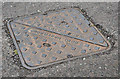
Walter Wilder access cover, Donaghadee
An access cover, at Barnagh Park, made by Walter Wilder & Son, Crowmarsh - possibly here Image The business was founded in 1865 and still exists although no longer a foundry.
Image: © Albert Bridge
Taken: 16 Jun 2013
0.07 miles
3
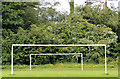
Goalposts, Donaghadee
Goalposts at the Crommelin Park playing fields.
Image: © Albert Bridge
Taken: 16 Jun 2013
0.10 miles
4
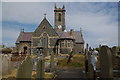
Donaghadee (CoI) parish church (1)
The first church on the site is thought to have been founded by St Patrick in the 5th century. In 1606 Sir Hugh Montgomery, of Ayrshire, was granted substantial lands in and around the Ards Peninsula. In 1626 he rebuilt the church by adding a cruciform church to an existing tower. The present tower dates from 1833 although there were plans, some 50 years earlier, for a new one. There were further alterations in 1877-78. The clock dates from 1892. A notable feature is that the front of the church faces a side entrance. The surrounding graveyard has many headstones from the 17th century – some of which are in an excellent state given their age.
Image: © Albert Bridge
Taken: 22 May 2007
0.13 miles
5
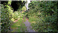
Path, Donaghadee
A path from Church Place Image (background), at the back of the parish church Image, running out to the Cannyreagh Road.
Image: © Albert Bridge
Taken: 7 Aug 2013
0.14 miles
6
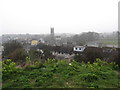
Donaghadee Parish Church viewed from The Moat
Image: © Eric Jones
Taken: 28 Mar 2017
0.14 miles
7
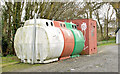
Recycling bins, Donaghadee (November 2014)
Recycling bins (mainly for glass) close to the Crommelin (Cromelon on the Google map) Park playing fields Image
Image: © Albert Bridge
Taken: 29 Nov 2014
0.15 miles
8
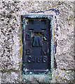
Flush Bracket, Donaghadee
Flush bracket on the front of Donaghadee Parish Church Image; it lies just to the right of the front entrance under the spire.
The number on the bracket is OSBM 3465.
The mark is 13.94 metres above MSL.
A flush bracket is a type of bench mark set onto the face of a building. See also http://www.geograph.org.uk/search.php?i=11037856 for many other examples I have found.
Image: © Rossographer
Taken: 1 Apr 2010
0.15 miles
9
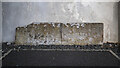
Gravestone, Donaghadee
Gravestone in the churchyard of Donaghadee parish church Image
"Here lieth the body of William Scott, Mariner, who died December 20 1660". It is one of at least two gravestones dating from 1660.
Image: © Rossographer
Taken: 23 Jul 2021
0.15 miles
10
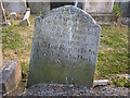
Gravestone, Donaghadee
Gravestone in the churchyard of Donaghadee parish church Image
At the top are the words "Inscribed by William Beggs of Donaghadee." Below that are:
"Here lyeth the body of Sara Sind wife to John Begs who departed this life June 5 1734 aged 34 years."
Below is a later inscription to a "Jane Begs wife of Thomas Begs who died February 3 1794 aged 21 years."
Below that are the words "Hugh Atkinson burying ground."
Image: © Rossographer
Taken: 23 Jul 2021
0.15 miles