1
Ballyholme View, 262 Seacliff Road, Ballyholme, Bangor
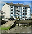
The front facade belonged to a Victorian hotel known as the Ballyholme Hotel. Later it was used as a nursing home. A few years ago most of the building was demolished, leaving the front facade remaining. This was incorporated into a new development of apartments which seem to have been completed in the period 2008 to 2010.
Image: © P L Chadwick
Taken: 9 Sep 2010
0.06 miles
2
Cairn Bay Lodge, Bangor
Cairn Bay Lodge is a large guesthouse and cafe on the Seacliff Road in Bangor. Taken during the Covid-19 pandemic, the banner is in support of NHS workers.
Image: © Rossographer
Taken: 3 Apr 2020
0.06 miles
3
Sea wall, Ballyholme promenade
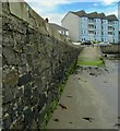
The wall around most of Ballyholme beach, which supports the promenade on top, was constructed in the late 1800s. It has generally faired well, although winter storms have occasionally damaged sections (which have subsequently been repaired). The apartments seen in
Image are in the background.
Image: © Rossographer
Taken: 15 Jul 2008
0.07 miles
4
Apartments, Ballyholme Bay
A large block of apartments on the Seacliff Road, Bangor, overlooking Ballyholme Bay (unseen to the right). Built in the last few years, the apartments replaced a derelict hotel, the name of which currently escapes me. The extreme western edge of Ballyholme beach (see http://www.geograph.org.uk/search.php?i=3092379 ) is in the foreground
Image: © Rossographer
Taken: 15 Jul 2008
0.07 miles
5
Public convenience near Seacliff Road, Ballyholme
Located on an elevated grassed area between the shore of Ballyholme Bay and Seacliff Road.
Image: © P L Chadwick
Taken: 9 Sep 2010
0.07 miles
6
Ballyholme Beach on a September evening, Ballyholme, Bangor
Looking west.
Image: © P L Chadwick
Taken: 9 Sep 2010
0.07 miles
7
Stormy seas [3]
Waves breaking against the esplanade at Ballyholme Beach.
Image: © Rossographer
Taken: 2 Dec 2007
0.07 miles
8
Apartments and Care Home overlooking Ballyholme Bay
Opposite the private care home are the buildings of the Ballyholme Yacht Club.
Image: © Eric Jones
Taken: 17 Apr 2017
0.07 miles
9
Kingsland Care Centre (1), 252 Seacliff Road, Ballyholme, Bangor
This care home is one of a number operated by Southern Cross Healthcare. It has also been known as Kingsland Care Home and Kingsland Nursing Home, according to signs outside.
Image
Image
Image: © P L Chadwick
Taken: 9 Sep 2010
0.08 miles
10
Promenade, Ballyholme
A high tide and brisk onshore breeze makes for difficult walking conditions as the waves crash against the promenade at Ballyholme beach, Bangor.
Image: © Rossographer
Taken: 9 Jan 2020
0.08 miles


![Stormy seas [3]](https://s1.geograph.org.uk/photos/62/58/625845_b0257e54_120x120.jpg)


