IMAGES TAKEN NEAR TO
Seacliff Road, BANGOR, BT20 5EY

Introduction

This page details the photographs taken nearby to Seacliff Road, BT20 5EY by members of the Geograph project.

The Geograph project started in 2005 with the aim of publishing, organising and preserving representative images for every square kilometre of Great Britain, Ireland and the Isle of Man.

There are currently over 7.5m images from over14,400 individuals and you can help contribute to the project by visiting https://www.geograph.org.uk

Image Map


Images are licensed for reuse under creativecommons.org/licenses/by-sa/2.0
Notes
  • Clicking on the map will re-center to the selected point.
  • The higher the marker number, the further away the image location is from the centre of the postcode.

Image Listing (1871 Images Found)

Images are licensed for reuse under creativecommons.org/licenses/by-sa/2.0
  • ...
Image
Details
Distance
1
Lifebuoy, Bangor
Lifebuoy at Bangor seafront. Bit of a test picture really - taken and uploaded using an iPhone.
Image: © Rossographer Taken: 1 Jul 2011
0.01 miles
2
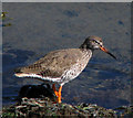
Redshank, Bangor
A redshank in the mud at low tide in the 'Long Hole', Bangor.
Image: © Rossographer Taken: 31 Mar 2008
0.01 miles
3
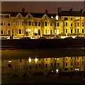
Reflections in the 'Long Hole' Bangor
A night view of terraced houses on the Seacliff Road in Bangor Image reflected in the still waters of the 'Long Hole'. A similar daylight scene is found at Image
Image: © Rossographer Taken: 13 Mar 2014
0.01 miles
4
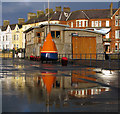
Bangor Lifeboat Station
A view of Bangor Lifeboat Station caught between heavy May showers. See also http://www.geograph.org.uk/search.php?i=6420134 for some related images.
Image: © Rossographer Taken: 18 May 2009
0.02 miles
5
Life buoy, Long Hole
Life buoy at the 'Long Hole' in Bangor. This was taken on a particularly pleasant June evening. The 'Long Hole' is behind with the terraces of the Seacliff Road behind. See also Image
Image: © Rossographer Taken: 20 Jun 2008
0.02 miles
6
DeLorean car, Bangor
DeLorean DMC-12 http://en.wikipedia.org/wiki/DeLorean_DMC-12 car parked on the Seacliff Road in Bangor. The cars were built in Dunmurry, Belfast, from 1981-2 and most were exported to the USA. Despite the local connection they are a rarity on the streets of Northern Ireland. See also http://www.geograph.org.uk/search.php?i=27092221 for more images of the cars on Geograph.
Image: © Rossographer Taken: 8 Dec 2011
0.02 miles
7
Inside the 'Long Hole' [1]
At low tide it is possible to walk along part of the seabed at the 'Long Hole' (see Image).
Image: © Rossographer Taken: 22 Apr 2008
0.02 miles
8
Relief lifeboat, Bangor
D-Class relief lifeboat 'Marjorie Wilkinson' D-680 outside Bangor Lifeboat Station Image The lifeboat had been brought to Belfast Lough specifically to work at the Tall Ships event and, with a crew from Bangor, worked the Belfast harbour area from 13th-16th August 2009. Here the lifeboat has been brought ashore and is preparing to depart following the end of the event. For a variety of other Geograph images taken during the Tall Ships event in Belfast see http://www.geograph.org.uk/search.php?i=7600363 .
Image: © Rossographer Taken: 16 Aug 2009
0.02 miles
9
Bangor Lifeboat Station
A glimpse through the door of Bangor Lifeboat Station. Part of the current lifeboat 'Jessie Hillyard' http://www.geograph.org.uk/search.php?i=6619097 can be seen through one open door. See also http://www.geograph.org.uk/search.php?i=6420134 for some related images.
Image: © Rossographer Taken: 12 Aug 2010
0.02 miles
10
'Alcohol Free Area' sign, Bangor
A much ignored sign from North Down Borough Council at the entrance to the Eisenhower Pier in Bangor.
Image: © Rossographer Taken: 10 Mar 2014
0.02 miles
  • ...