IMAGES TAKEN NEAR TO
Beatrice Road, BANGOR, BT20 5DG

Introduction

This page details the photographs taken nearby to Beatrice Road, BT20 5DG by members of the Geograph project.

The Geograph project started in 2005 with the aim of publishing, organising and preserving representative images for every square kilometre of Great Britain, Ireland and the Isle of Man.

There are currently over 7.5m images from over14,400 individuals and you can help contribute to the project by visiting https://www.geograph.org.uk

Image Map


Images are licensed for reuse under creativecommons.org/licenses/by-sa/2.0
Notes
  • Clicking on the map will re-center to the selected point.
  • The higher the marker number, the further away the image location is from the centre of the postcode.

Image Listing (628 Images Found)

Images are licensed for reuse under creativecommons.org/licenses/by-sa/2.0
  • ...
Image
Details
Distance
1
Beatrice Road, Bangor
Beatrice Road in Bangor on a foggy night.
Image: © Rossographer Taken: 30 Sep 2015
0.01 miles
2
McVeigh, High Street, Bangor
This little shop ceased trading a few years ago and now looks very out of sorts in High Street.
Image: © Rossographer Taken: 13 Apr 2008
0.02 miles
3
Post, Prospect Road
Concrete Post - I'm not sure what or why!
Image: © Rossographer Taken: 21 Oct 2007
0.02 miles
4
Beatrice Road, Bangor
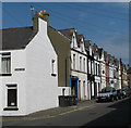
Street composed of terraced housing running from Bingham Street to Prospect Road.
Image: © Rossographer Taken: 3 May 2008
0.02 miles
5
Closed shop, Bangor
The former shop 'McVeigh' (described in Image) which has not changed since it closed suddenly around 13 years ago, is now advertised for sale. The shop is at 98 High Street, Bangor.
Image: © Rossographer Taken: 5 Mar 2013
0.02 miles
6
Beatrice Avenue off the High Street, Bangor
Image: © Eric Jones Taken: 17 Apr 2017
0.03 miles
7
Shop, Bangor
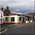
'Flooring Inspirations' shop at 57 Prospect Road, Bangor. Not listed, but mentioned in the Historic Buildings Register for Northern Ireland HB23/05/030, this shop was built c1900-1919 and was believed to be originally used as a bakery. It appears to warrant a mention due to its Belfast Truss roof (wooden rather than iron I believe). According to the DoE http://www.doeni.gov.uk/niea/ "The Belfast truss was developed in the mid-nineteenth century to meet the demand for efficient, lightweight and long span roofs brought about by the industrial revolution."
Image: © Rossographer Taken: 10 Mar 2012
0.03 miles
8
'For Sale' and 'To Let' signs, Bangor
Five signs (by coincidence all from the same agent) on a short stretch of High Street in Bangor. Sadly this is somewhat indicative of much of High Street and the town in general at the moment.
Image: © Rossographer Taken: 2 May 2014
0.03 miles
9
Election posters, Bangor
Election posters on High Street in Bangor for Noelle Robinson of the Green Party in Northern Ireland http://www.greenpartyni.org/ (council election), Mark Brotherston of the Northern Ireland Conservatives http://www.niconservatives.com/ and Jim Allister of the Traditional Unionist Voice http://tuv.org.uk/ (both standing in the European election).
Image: © Rossographer Taken: 2 May 2014
0.03 miles
10
High Street, Bangor
The former shop at 98 High Street in Bangor (McVeigh - see previous at http://www.geograph.org.uk/search.php?i=165800340 ) has now been refurbished and is for sale again, having remained unoccupied for over 20 years. Although all windows and the door have been replaced, the frontage remains, complete with the last traditional remaining shopfront signage in the town.
Image: © Rossographer Taken: 19 Sep 2022
0.03 miles
  • ...