IMAGES TAKEN NEAR TO
Castle Park Road, BANGOR, BT20 4TD

Introduction

This page details the photographs taken nearby to Castle Park Road, BT20 4TD by members of the Geograph project.

The Geograph project started in 2005 with the aim of publishing, organising and preserving representative images for every square kilometre of Great Britain, Ireland and the Isle of Man.

There are currently over 7.5m images from over14,400 individuals and you can help contribute to the project by visiting https://www.geograph.org.uk

Image Map


Images are licensed for reuse under creativecommons.org/licenses/by-sa/2.0
Notes
  • Clicking on the map will re-center to the selected point.
  • The higher the marker number, the further away the image location is from the centre of the postcode.

Image Listing (90 Images Found)

Images are licensed for reuse under creativecommons.org/licenses/by-sa/2.0
  • ...
Image
Details
Distance
1
2019 Election poster, Bangor
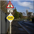
Stephen Farry for the Alliance Party on the Bloomfield Road in Bangor.
Image: © Rossographer Taken: 8 Dec 2019
0.08 miles
2
Pillar box, Bangor
EIIR pillar box (BT20 156) on the eastern side of the Bloomfield Road, just outward of Pitcairn Avenue.
Image: © Albert Bridge Taken: 5 Apr 2012
0.09 miles
3
2019 Election poster, Bangor
Alex Easton for the Democratic Unionist Party at the junction of the Bloomfield and Gransha roads in Bangor (Stephen Farry for the Alliance Party is behind).
Image: © Rossographer Taken: 8 Dec 2019
0.10 miles
4
River, Bangor
The name of the river in Bangor remains a mystery. It’s not named on the 1:10,000 street map and much Googling (including adding “Rivers Agency”) is no help. Much of it follows an artificial course, as here between Castle Street and the Ward Park tennis courts (right). See also Image for a view a bit further downstream.
Image: © Albert Bridge Taken: 5 Apr 2012
0.10 miles
5
Theatre construction, Bangor
A new "£12m performing arts and technology innovation centre" http://www.bbc.co.uk/news/uk-northern-ireland-24654771 under construction on Castle Park Road in Bangor. The centre is part of South Eastern Regional College.
Image: © Rossographer Taken: 2 Nov 2014
0.11 miles
6
Manhole cover, Bangor
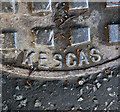
Detail of the manhole cover on the Gransha Road in Bangor seen in Image It is marked 'Kesgas' and the British Standard BS 497. Further information welcomed.
Image: © Rossographer Taken: 17 May 2012
0.11 miles
7
Manhole cover, Bangor
Manhole cover on the Gransha Road in Bangor. It is marked 'Kesgas' and the British Standard BS 497. Further information welcomed. Image shows the 'Kesgas' name in detail.
Image: © Rossographer Taken: 17 May 2012
0.11 miles
8
Bench Mark, Bangor
Cut bench mark at the bottom of a wall at the end of Bloomfield Road at the junction with Gransha Road in Bangor. See also http://www.geograph.org.uk/search.php?i=11037856 for many other examples I have found.
Image: © Rossographer Taken: 5 Mar 2010
0.11 miles
9
Bangor Academy and Sixth Form College
Recently opened school on Castle Park Avenue - see Image for a view of the site during construction.
Image: © Rossographer Taken: 28 Oct 2008
0.12 miles
10
New School Construction
New site of Bangor Academy and Sixth Form Centre, on the site formerly occupied by Glenlola Collegiate on Castle Park Road. See http://www.bangoracademy.ik.org/home.ikml for more information. See also Image for a (partial) view on completion.
Image: © Rossographer Taken: 21 Oct 2007
0.12 miles
  • ...