
IMAGES TAKEN NEAR TO
Lorelei, BANGOR, BT20 3TF
Introduction
This page details the photographs taken nearby to Lorelei, BT20 3TF by members of the Geograph project.
The Geograph project started in 2005 with the aim of publishing, organising and preserving representative images for every square kilometre of Great Britain, Ireland and the Isle of Man.

There are currently over 7.5m images from over14,400 individuals and you can help contribute to the project by visiting https://www.geograph.org.uk
Image Map
Images are licensed for reuse under creativecommons.org/licenses/by-sa/2.0
Notes
- Clicking on the map will re-center to the selected point.
- The higher the marker number, the further away the image location is from the centre of the postcode.
Image Listing (755 Images Found)
Images are licensed for reuse under creativecommons.org/licenses/by-sa/2.0
Image
Details
Distance
1
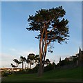
Pine trees, Bangor
Large pine trees located on the coastal path near Pickie in Bangor.
Image: © Rossographer
Taken: 2 Jun 2008
0.01 miles
2
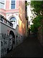
Lane, bangor
A lane running from the coastal path at Pickie up to the Princetown Road. The terrace 'Lorelei' runs off to the left behind the graffiti.
Image: © Rossographer
Taken: 2 Jun 2008
0.02 miles
3

The Pickie swans, Bangor
The mute swans (novelty pedalos) at Pickie Fun Park in Bangor have just been brought out of 'hibernation' ready for the new summer season.
Image: © Rossographer
Taken: 20 Mar 2008
0.03 miles
4
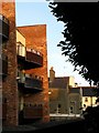
Apartments and houses, Bangor
The rear of the recently constructed apartments at Lorelei in Bangor, alongside the rear returns of older victorian houses.
Image: © Rossographer
Taken: 2 Jun 2008
0.04 miles
5
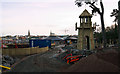
Pickie Fun Park redevelopment, Bangor
Work well underway to redevelop the popular Pickie Fun Park in Bangor. Work began in September 2011 and should be completed by Easter 2012. The blurb from the council states that:
"Plans include a total refurbishment of existing features and new exciting activities including:
- 18 hole mini golf course
- Children’s electric car track
- Splash pad
The Pickie Puffer will also receive a upgrade to its route whilst the existing café will receive a facelift including better indoor and outdoor seating, and new toilet facilities.
Landscaping of the area will help to create quiet spaces, sensory gardens, picnic areas and educational areas." From http://www.northdown.gov.uk/template1.asp?pid=1157&area=5
See also http://www.geograph.org.uk/search.php?i=28308350 for related images.
Image: © Rossographer
Taken: 22 Jan 2012
0.04 miles
6
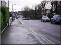
Princetown Road, Bangor
Seen here at Lorelei. The Princetown Road one of Bangor's most exclusive avenues.
Image: © Dean Molyneaux
Taken: 22 Dec 2009
0.04 miles
7
![Rainbow over Bangor Marina [3]](https://s1.geograph.org.uk/photos/71/79/717941_23f0b63a_120x120.jpg)
Rainbow over Bangor Marina [3]
The left hand side of the rainbow seen in Image ended past the marina, only some twenty yards in front of me. The view is over part of the coastal path past Pickie in front of me with the North Channel beyond.
Image: © Rossographer
Taken: 7 Mar 2008
0.05 miles
8
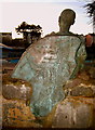
'The pastie Supper' sculpture, Bangor
The reverse of the sculpture shown in Image shows an old map of Bangor.
Image: © Rossographer
Taken: 24 Dec 2007
0.05 miles
9
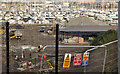
Pickie redevelopment, Bangor
Work underway at the Pickie Fun Park. It started September 2011. Plans include a complete refurbishment of existing features and new facilities including an 18 hole mini golf course, children’s electric car track and a splash pad.
Image: © Albert Bridge
Taken: 1 Dec 2011
0.05 miles
10
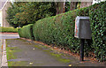
Drop box, Bangor
Drop box at the Princetown Road end of the Downshire Road.
Image: © Albert Bridge
Taken: 15 Sep 2011
0.05 miles