
IMAGES TAKEN NEAR TO
Clandeboye Road, BANGOR, BT20 3LA
Introduction
This page details the photographs taken nearby to Clandeboye Road, BT20 3LA by members of the Geograph project.
The Geograph project started in 2005 with the aim of publishing, organising and preserving representative images for every square kilometre of Great Britain, Ireland and the Isle of Man.

There are currently over 7.5m images from over14,400 individuals and you can help contribute to the project by visiting https://www.geograph.org.uk
Image Map
Images are licensed for reuse under creativecommons.org/licenses/by-sa/2.0
Notes
- Clicking on the map will re-center to the selected point.
- The higher the marker number, the further away the image location is from the centre of the postcode.
Image Listing (47 Images Found)
Images are licensed for reuse under creativecommons.org/licenses/by-sa/2.0
Image
Details
Distance
1
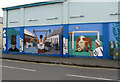
Mural, Hazelbrook Avenue, Bangor
A mural on the side of a shop. It reflects some of the local history of the Clandeboye Road (now under the moniker of 'Clandeboye Village') area of the town.
Image: © Rossographer
Taken: 2 May 2008
0.03 miles
2
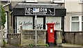
Pillar box, Bangor
GVIR pillar box (BT20 588), on the Clandeboye Road, near the corner of Hazelbrook Avenue (out of picture to the left).
Image: © Albert Bridge
Taken: 1 May 2012
0.03 miles
3
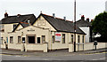
Ebenezer gospel hall, Bangor
The “Ebenezer” gospel hall, at the corner of Church Street and Hazelbrook Avenue (right). Built in 1932 and described as “Gabled roughcast hall four bays deep, with additional porch and side hall”. In this context "Ebenezer" is not a man’s name rather a translation from the Hebrew meaning "a rock of help". Image shows the new hall under construction on the other side of Church Street.
Image: © Albert Bridge
Taken: 15 Oct 2011
0.04 miles
4
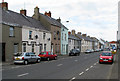
Church Street, Bangor
Looking along Church Street towards Bangor Abbey from near the junction with Clandeboye Road.
Image: © Rossographer
Taken: 2 May 2008
0.06 miles
5
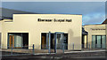
The new Ebenezer gospel hall, Bangor (2)
See Image (October 2011). The completed hall.
Image: © Albert Bridge
Taken: 1 Jan 2013
0.09 miles
6
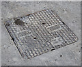
Manhole cover, Bangor
Manhole cover located on Church Street in Bangor Image
The cover was manufactured by Durey Castings http://www.dureycastings.co.uk/ .
Image: © Rossographer
Taken: 2 May 2012
0.09 miles
7
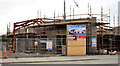
The new Ebenezer gospel hall, Bangor
See Image A new “Ebenezer” gospel hall is now under construction, nearby, on the other side of Church Street. Architect, Brian Payne Architects Limited. Image (January 2013) shows the completed hall.
Image: © Albert Bridge
Taken: 15 Oct 2011
0.09 miles
8
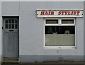
Hairdresser, Church Street, Bangor
Apart from the uPVC window, I doubt if this little hairdresser has changed much in decades. It is still open for business.
Image: © Rossographer
Taken: 2 May 2008
0.09 miles
9
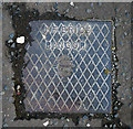
Drain cover, Bangor
Drain cover on the Belfast Road, Bangor, bearing the name "J.F. Brice". A brief search of the records shows a coal importer J.F. Brice living in Farnham Road, Bangor, in 1910; there were also commercial premises named "Auction Mart (J.F. Brice & Son)" at 6 Central Avenue Image It is also possible that this is the same J.F. Brice who donated land off the Donaghadee Road to the borough to be used as a public park - Image Further information welcomed.
Image: © Rossographer
Taken: 12 Oct 2010
0.13 miles
10
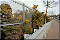
Railway safety measures, Bangor
The railway and the Belfast Road run very close and parallel for a short distance on the outward side of the Boyne Bridge Image The fence stops human trespass. The crash barrier stops runaway vehicles.
Image: © Albert Bridge
Taken: 2 Mar 2010
0.14 miles