IMAGES TAKEN NEAR TO
Ballymacormick Park, BANGOR, BT19 6BX

Introduction

This page details the photographs taken nearby to Ballymacormick Park, BT19 6BX by members of the Geograph project.

The Geograph project started in 2005 with the aim of publishing, organising and preserving representative images for every square kilometre of Great Britain, Ireland and the Isle of Man.

There are currently over 7.5m images from over14,400 individuals and you can help contribute to the project by visiting https://www.geograph.org.uk

Image Map


Images are licensed for reuse under creativecommons.org/licenses/by-sa/2.0
Notes
  • Clicking on the map will re-center to the selected point.
  • The higher the marker number, the further away the image location is from the centre of the postcode.

Image Listing (26 Images Found)

Images are licensed for reuse under creativecommons.org/licenses/by-sa/2.0
  • ...
Image
Details
Distance
1
Lane near Bangor [2]
Looking down towards the Ballymacormick Road towards where Image was taken. See also Image
Image: © Rossographer Taken: 18 Apr 2008
0.05 miles
2
Lane near Bangor [1]
A small lane that runs from the end of the Ballymacormick Road (the start of which can be seen in Image) to the Springwell Road. On the 1901 OS maps the lane is shown as a continuation of the track that was to become (or already was) the Ballymacormick Road. Although the road was enlarged in the 1960's/1970's to accommodate growing suburban Bangor, the lane was left largely untouched. It had been used by farmers to access neighbouring fields but even this has largely been abandoned in recent years. Walkers continue to use it as a path - without them it would quickly become overgrown and inaccessible. It appears to be nameless but one local resident of some 80 years claims that it has always known as 'Cushings Lane'; other names I have heard include 'Foxtrot Lane' or simply 'The Lane'.
Image: © Rossographer Taken: 18 Apr 2008
0.05 miles
3
Horses near Bangor
Horses in a field off Image They are very friendly and came running over to me - probably because local walkers feed them carrots!
Image: © Rossographer Taken: 18 Apr 2008
0.06 miles
4
Ballymacormick Drive, Bangor
Suburban street on the north-eastern edge of Bangor.
Image: © Rossographer Taken: 30 Jan 2010
0.06 miles
5
Whin bushes in bloom near Bangor
Flowering whin bushes on the Image
Image: © Rossographer Taken: 18 Apr 2008
0.06 miles
6
Delivery van, Bangor
A 'Tesco' van making a delivery to a house on Ballymacormick Drive in Bangor.
Image: © Rossographer Taken: 7 Aug 2014
0.06 miles
7
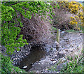
Stream, Ballymacormick Road, Bangor
A small stream right at the end of the Ballymacormick Road. It flows through farmland and into the sea at the western end of Groomsport close to the entrance to Ballymacormick Point - see Image
Image: © Rossographer Taken: 18 Apr 2008
0.06 miles
8
Snowdrops, Bangor
Snowdrops growing under a hedgerow on the Ballymacormick Road on the northern edge of Bangor.
Image: © Rossographer Taken: 30 Jan 2010
0.07 miles
9
Former Bangor Grammar Playing Fields
See Image The school moved to a new site on the Gransha Road in Bangor in early 2013 (see http://www.geograph.org.uk/snippet/8816 ). The new site has extensive grounds so the old playing fields at Ballymacormick are surplus to requirements. This is a view of the eastern rugby pitches with the goal posts still in situ (although note that the crossbar in one has partially collapsed).
Image: © Rossographer Taken: 18 Apr 2014
0.09 miles
10
Ballymacormick Road, Bangor
The Ballymacormick Road starts beside the Groomsport Road roundabout and marks the northern end of Bangor town. This is the view east towards farmland.
Image: © Albert Bridge Taken: 18 Jul 2006
0.09 miles
  • ...