IMAGES TAKEN NEAR TO
Glastry Court, BANGOR, BT19 1WH

Introduction

This page details the photographs taken nearby to Glastry Court, BT19 1WH by members of the Geograph project.

The Geograph project started in 2005 with the aim of publishing, organising and preserving representative images for every square kilometre of Great Britain, Ireland and the Isle of Man.

There are currently over 7.5m images from over14,400 individuals and you can help contribute to the project by visiting https://www.geograph.org.uk

Image Map


Images are licensed for reuse under creativecommons.org/licenses/by-sa/2.0
Notes
  • Clicking on the map will re-center to the selected point.
  • The higher the marker number, the further away the image location is from the centre of the postcode.

Image Listing (13 Images Found)

Images are licensed for reuse under creativecommons.org/licenses/by-sa/2.0
Image
Details
Distance
1
Speed limit sign, Bangor (2)
After the 60 Image, the speed limit reduces to 40mph as the Belfast Road Image approaches the flyover Image and the ring road Image following Image The signs are supported by road markings.
Image: © Albert Bridge Taken: 3 Jan 2012
0.14 miles
2
Advance direction sign, Bangor
An advance direction sign, on the Belfast Road Image, approaching the flyover Image and the ring road Image
Image: © Albert Bridge Taken: 3 Jan 2012
0.15 miles
3
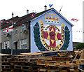
Loyalist mural, Bangor
Detail of Image showing the loyalist mural on the gable wall of a house at Kilcooley in Bangor.
Image: © Rossographer Taken: 13 Jun 2008
0.18 miles
4
Bonfire at Kilcooley, Bangor
The traditional gathering of material for the annual bonfire on the 11th July, a familiar sight throughout loyalist areas of Northern Ireland. 'Dump Wood Only' is the result of action to stop the illegal burning of tyres.
Image: © Rossographer Taken: 13 Jun 2008
0.19 miles
5
Bonfire, Bangor
Traditional loyalist '11th night' bonfire at the Kilcooley Estate in Bangor. In recent years bonfires have grown ever bigger with competitions between rival groups to see who can make the biggest; this one looked around 10 metres high and there are teenagers near the top adding the finishing touches. The two catering vans are temporary and will cater for the huge crowds coming to watch it burn a few hours after this was taken.
Image: © Rossographer Taken: 11 Jul 2019
0.20 miles
6
Sculpture, Kilcooley, Bangor [2]
Closer detail of the 'Kilcooley Obelisks' described in Image
Image: © Rossographer Taken: 13 Jun 2008
0.21 miles
7
Sculpture, Kilcooley, Bangor [1]
Sculpture on Drumhirk Drive in Kilcooley, Bangor. Known as the 'Kilcooley Obelisks', the sculpture consists of five solid oak obelisks, each representing a different decade from the 1960s (when Kilcooley Estate was established) up to the present day. Local residents’ own personal photographs have then been screen printed onto copper and attached to the obelisks creating a "visual timeline of Kilcooley". See also Image
Image: © Rossographer Taken: 13 Jun 2008
0.22 miles
8
Orlock Gardens, Bangor
Located in the Kilcooley Estate,
Image: © Dean Molyneaux Taken: 5 Dec 2009
0.22 miles
9
Ballynoe Gardens, Bangor (October 2014)
Ballynoe Gardens is part of the Kilcooley estate. The estate was built over a period in the 1960’s/70’s when large estates were fashionable and green spaces such as that in the foreground and here Image were automatic provisions. It housed mainly what was called “overspill” from east Belfast. At the time of planning and construction officialdom considered that Belfast had reached its maximum size and was unlikely to see any significant new development – a doubtful concept as we now know. The 1970 Development Plan makes interesting reading (with hindsight).
Image: © Albert Bridge Taken: 2 Oct 2014
0.23 miles
10
Sir Edward Bingham Mural, Kilcooley
This mural was painted in September 2009. It depicts local war veteran Sir Edward Bingham O.B.E. - a sailor who was awarded the Victoria Cross for courageous actions in the Battle of Jutland. Located at Orlock Gardens in Bangor's Kilcooley Estate.
Image: © Dean Molyneaux Taken: 5 Dec 2009
0.24 miles