IMAGES TAKEN NEAR TO
Lyndhurst Avenue, BANGOR, BT19 1AY

Introduction

This page details the photographs taken nearby to Lyndhurst Avenue, BT19 1AY by members of the Geograph project.

The Geograph project started in 2005 with the aim of publishing, organising and preserving representative images for every square kilometre of Great Britain, Ireland and the Isle of Man.

There are currently over 7.5m images from over14,400 individuals and you can help contribute to the project by visiting https://www.geograph.org.uk

Image Map


Images are licensed for reuse under creativecommons.org/licenses/by-sa/2.0
Notes
  • Clicking on the map will re-center to the selected point.
  • The higher the marker number, the further away the image location is from the centre of the postcode.

Image Listing (7 Images Found)

Images are licensed for reuse under creativecommons.org/licenses/by-sa/2.0
Image
Details
Distance
1
Tree by Tesco, Bangor [2]
A closer look at the tree seen in Image; the lines in the road in front were made by a road sweeping lorry cleaning the road of debris from the 'Tesco' construction.
Image: © Rossographer Taken: 8 Apr 2008
0.16 miles
2
Tree by Tesco, Bangor
A solitary tree on Kileen Avenue with the new 'Tesco' store that has replaced the old Springhill Shopping Centre emerging to the left.
Image: © Rossographer Taken: 8 Apr 2008
0.18 miles
3
Pillar box, Bangor
EIIR pillar box, at Killeen Avenue opposite Killeen Drive, close to Tesco Springhill (background). Image shows it from a different angle.
Image: © Albert Bridge Taken: 3 Jan 2012
0.18 miles
4
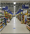
Tesco, Bangor
Interior of the Tesco store at Springhill, Bangor. Taken late in the evening - hence few other shoppers around. Looking at old maps, the centre looks to be named after what was a farm or large house called Spring Hill which sat close by. Also of note is what looked like an adjacent ring fort named Fort Hill. Both structures have been long since been obliterated.
Image: © Rossographer Taken: 18 Jan 2021
0.18 miles
5
Bangor West station, Northern Ireland Railways
The Belfast and County Down Railway opened a station at Bangor West in 1928 to cater for the expanding population in the area. The railway remains a favourite way of travelling to work in Belfast. The photo shows returning commuters alighting from the 17.05 Belfast (Gt. Victoria St) - Bangor.
Image: © Albert Bridge Taken: 28 Jun 2006
0.20 miles
6
Pillar box, Bangor
This EIIR pillar box has the number BT20 93 and is outside the Bryansburn post office on the Rathmore Road, almost opposite Innisfayle Drive. The post office (inside a “Spar”) has the postcode BT19 1DL. The difference is attributable to the post code of the sorting office. My thanks to the Letter Box Study Group http://www.lbsg.org/ for the explanation.
Image: © Albert Bridge Taken: 27 Mar 2012
0.22 miles
7
Crawfordsburn Road, Bangor
Looking towards the centre of Bangor from Carnalea.
Image: © Rossographer Taken: 22 Mar 2008
0.23 miles