1
Frosty grass, Seymour Hill, Derriaghy
Today was the first real frost of the 2012/13 winter. It lingered until almost noon. This scene is at Yew Tree Walk, looking towards the Derryaghy River
Image (below the trees in the background).
Image: © Albert Bridge
Taken: 24 Nov 2012
0.06 miles
2
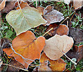
Frosty leaves, Seymour Hill, Derriaghy
Today was the first real frost of the 2012/13 winter. It lingered until almost noon. These frosty leaves were on a large area of undisturbed grass at Yew Tree Walk, close to here
Image Another member has suggested that these unusually-shaped leaves might be from a tulip tree http://en.wikipedia.org/wiki/Liriodendron.
Image: © Albert Bridge
Taken: 24 Nov 2012
0.06 miles
3
Frosty grass, Seymour Hill, Derriaghy (1)
Today was the first real frost of the 2012/13 winter. It lingered until almost noon. This scene is at Yew Tree Walk, close to Kingsway (background).
Image: © Albert Bridge
Taken: 24 Nov 2012
0.07 miles
4
Seymour Hill House, Derriaghy
Now converted to housing association flats, Seymour Hill House was built in 1789 for Robert Johnston who owned a local bleach green. It later passed into the ownership of the Charley family
Image Restored, after a fire in 1986, under the supervision of Consarc Architects. Last seen in
Image (November 2005). See also
Image
Image: © Albert Bridge
Taken: 24 Nov 2012
0.07 miles
5
Gate and wall, Seymour Hill, Derriaghy
See
Image This wall, at Yew Tree Walk, encloses the house’s former walled garden. Now known as the Seymour Hill Horticultural Unit it “supports over 40 adults with a learning disability and offers a broad range of training within a commercial garden centre. Clients are involved in the production of plants, retail outlet, landscaping and manufacturing hanging baskets, which are sold both to local businesses and the general public within the Dunmurry and Seymour Hill area”.
Image: © Albert Bridge
Taken: 24 Nov 2012
0.07 miles
6
Wooded path, Derriaghy (July 2014)
A wooded path, partly lined with laurel bushes, on the south western side of the Derryaghy River, to the north of Yew Tree Walk.
Image: © Albert Bridge
Taken: 19 Jul 2014
0.07 miles
7
The Derryaghy River, Dunmurry
The short Derryaghy River (looking upstream) flowing through Derryaghy Linear Park, near Seymour Hill.
Image: © Albert Bridge
Taken: 7 Apr 2010
0.10 miles
8
Frosty grass, Seymour Hill, Derriaghy (3)
Today was the first real frost of the 2012/13 winter. It lingered until almost noon. This scene is at Yew Tree Walk, near Seymour Hill House, looking towards the Derryaghy River
Image (below the trees in the background).
Image: © Albert Bridge
Taken: 24 Nov 2012
0.12 miles
9
Religious message, Seymour Hill, Dunmurry
Attached to a tree at Kingsway/Yew Tree Walk.
Image: © Albert Bridge
Taken: 23 Mar 2012
0.12 miles
10
Bridge, Kingsway, Dunmurry (1)
The bridge carrying Kingsway
Image across the Derryaghy River
Image, near Seymour Hill. Seen from this angle it seems to have been modified once or, possibly twice, over the years. Kingsway is part of the Belfast (right) – Lisburn road. See also
Image
Image: © Albert Bridge
Taken: 7 Apr 2010
0.13 miles


