1
Aberdelghy golf course, Derriaghy (2)
Part of the northern end of the course.
Image: © Albert Bridge
Taken: 7 Jan 2012
0.08 miles
2
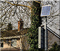
Solar panel, Derriaghy
A solar panel, on the River Road near Glenwood Park, powering the flashing lights on a “school” sign.
Image: © Albert Bridge
Taken: 23 Mar 2012
0.09 miles
3
Pillar box, Seymour Hill, Derriaghy
An EIIR pillar box (BT17 843), with a coating of graffiti, on the River Road close to Glenwood Park.
Image: © Albert Bridge
Taken: 23 Mar 2012
0.10 miles
4
Railway Bridge
An unidentified train crossing Mc Master's railway bridge approaching Derriaghy station which is to the left of the photo. The bridge was raised and widened in the late 1950's/60's to allow double-deck buses to pass under, only the righthand arch and abutment remain of the original bridge, the girder section and abutment to the leftof the photo are new.
Image: © Wilson Adams
Taken: 18 Jan 2003
0.10 miles
5
Seymour Hill Methodist Church
Situated in a large modern housing estate.
Image: © Brian Shaw
Taken: 24 Nov 2005
0.10 miles
6
Aberdelghy golf course, Derriaghy
Aberdelghy golf course
Image stretches from Lambeg to Derriaghy. This is the northern end near Conway Lane.
Image: © Albert Bridge
Taken: 28 May 2011
0.12 miles
7
Aberdelghy golf course, Derriaghy (4)
Part of the northern end of the course, near the railway.
Image: © Albert Bridge
Taken: 7 Jan 2012
0.12 miles
8
Aberdelghy golf course, Derriaghy (3)
Part of the northern end of the course.
Image: © Albert Bridge
Taken: 7 Jan 2012
0.13 miles
9
Bus terminus, Seymour Hill, Derriaghy
The terminus on the River Road used by buses operating the Conway/Seymour Hill service. An Alexander-bodied Volvo 2967 (BEZ 8967) in the Metro fleet is awaiting departure with the 11.16 to Wellington Place via the Lisburn Road.
Image: © Albert Bridge
Taken: 23 Mar 2012
0.14 miles
10
Train, Derriaghy (2012-1)
A C3K set (3008) approaching Derriaghy station with the 11.15 Portadown - Bangor. The last of the lingering mist can be seen in the background, towards Lambeg.
Image: © Albert Bridge
Taken: 23 Mar 2012
0.18 miles


