1
Artillery flats, Belfast (2013-2)
See
Image Two of the blocks, at North Queen Street, rising above the roofs and chimneys at Gt George’s Street
Image: © Albert Bridge
Taken: 31 Jul 2013
0.02 miles
2
Artillery Flats, Belfast (3 in 2013)
Part of one of the blocks seen, across the rooftops, from Frederick Street.
Image: © Albert Bridge
Taken: 6 Sep 2013
0.05 miles
3
Artillery flats, Belfast (2013-1)
See
Image Three of the blocks, at North Queen Street, seen from the York Street end of Henry Street. Part of the former “Gallahers” factory
Image and
Image is on the right. Continue to
Image
Image: © Albert Bridge
Taken: 31 Jul 2013
0.07 miles
4
Artillery flats, Belfast
The view from Brougham Street
Image
Image: © Albert Bridge
Taken: 5 Feb 2010
0.08 miles
5
The Artillery Flats from Clifton House
The Artillery Flats, so called because they were built on the site of a former artillery barracks, are in the heart of the strongly republican New Lodge district.
https://commons.wikimedia.org/wiki/File:Artillery_Flats,_Belfast,_July_2010_(02).JPG
Image: © Eric Jones
Taken: 10 Jul 2015
0.08 miles
6
Apartments in Carlisle Road, Belfast
These stand adjacent to the Artillery Flats. The image is taken from the Westlink
a dual carriageway throughpass, designated the A12, and connecting the M1 to the M2 and M3 motorways
Image: © Eric Jones
Taken: 9 Aug 2011
0.09 miles
7
New Lodge Tower Blocks
Image: © Michael Parry
Taken: 19 Apr 2005
0.09 miles
8
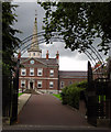
Clifton House
Entrance gates to Clifton House
One of Belfast’s most historic buildings, Clifton House was completed in 1774 by the Belfast Charitable Society as a base for their work with the poor and needy. It is usually open for tours during the European Heritage Open Days in September each year and is well worth a visit. http://www.cliftonbelfast.org.uk/home.htm
Image: © Rossographer
Taken: 30 Jul 2007
0.09 miles
9
Crumlin Road Courthouse
Now derelict, the Crumlin Road Courthouse was designed by the architect Charles Lanyon and completed in 1850. It is situated across the road from the Crumlin Road Gaol and the two are linked by an underground passage.
Until closure in 1998 it was the scene of many high profile terrorist trials; Belfast Crown Court has now moved to Oxford Street.
The building is currently awaiting redevelopment, with rumours that it is to be turned into a 5-star hotel.
Image: © Rossographer
Taken: 8 Aug 2007
0.09 miles
10
Former Friends Meeting House, Belfast
The former meeting house, in Frederick Street, was built in 1840. It is now the office of a charity. The Society of Friends still meets to the side and rear of the building.
Image: © Albert Bridge
Taken: 4 Oct 2007
0.09 miles


