IMAGES TAKEN NEAR TO
Corporation Square, BELFAST, BT1 3AL

Introduction

This page details the photographs taken nearby to Corporation Square, BT1 3AL by members of the Geograph project.

The Geograph project started in 2005 with the aim of publishing, organising and preserving representative images for every square kilometre of Great Britain, Ireland and the Isle of Man.

There are currently over 7.5m images from over14,400 individuals and you can help contribute to the project by visiting https://www.geograph.org.uk

Image Map


Images are licensed for reuse under creativecommons.org/licenses/by-sa/2.0
Notes
  • Clicking on the map will re-center to the selected point.
  • The higher the marker number, the further away the image location is from the centre of the postcode.

Image Listing (1536 Images Found)

Images are licensed for reuse under creativecommons.org/licenses/by-sa/2.0
  • ...
Image
Details
Distance
1
Extension, Belfast Harbour Office
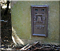
Belfast Harbour Office Image and https://www.belfast-harbour.co.uk/legacy/history-harbour-office is a well-known example of Victorian architecture. The northward extension (which might date from the early 1970’s), now clad in a matching stone, is not well documented. This plaque Image is at middle left.
Image: © Albert Bridge Taken: 21 Nov 2013
0.00 miles
2
Anchors, Clarendon Dock, Belfast
Two huge old anchors placed near Clarendon Dock in Belfast.
Image: © Rossographer Taken: 25 Jun 2008
0.02 miles
3
Flush Bracket, Belfast
Flush bracket on the south-eastern corner of the Belfast Harbour Commissioner's Office Image on Corporation Square, Belfast. It lies hidden behind shrubs around the building but is easy to access. The number on the bracket is OSBM 3197. The mark is 2.90 metres above MSL. A flush bracket is a type of bench mark set onto the face of a building. See also http://www.geograph.org.uk/search.php?i=11037856 for many other examples I have found.
Image: © Rossographer Taken: 14 Apr 2010
0.02 miles
4
The Harbour Office, Belfast (1)
The Harbour Office was built in 1852/54 and substantially modified by WH Lynn in 1891/95. This, the Corporation Square side, is by Lynn. See also Image
Image: © Albert Bridge Taken: 24 Oct 2010
0.02 miles
5
The Harbour Office, Belfast (2)
See Image The main entrance – facing Corporation Square.
Image: © Albert Bridge Taken: 24 Oct 2010
0.02 miles
6
Harbour site, Belfast
A tarmaced area, immediately east of the Harbour Office. A model of the proposed City Quays development, on the Harbour Commissioners’ website, shows it as part of redevelopment site.
Image: © Albert Bridge Taken: 24 Oct 2010
0.02 miles
7
Clock tower, the Harbour Office, Belfast (February 2014)
See Image (October 2007). A completely different view of the clock tower on the Harbour Office, from the south west at Tomb Street, showing the balustrades and carved fruit found in many Victorian buildings – not just Lanyon (here) and but other architects too Image Image
Image: © Albert Bridge Taken: 27 Feb 2014
0.03 miles
8
Belfast Tall Ships Event 2009
This was 10am and had not been cleared
Image: © HENRY CLARK Taken: 14 Aug 2009
0.03 miles
9
Dry Dock 1, Clarendon Dock, Belfast
A view over the Dry Dock 1 at Clarendon Dock in Belfast, the oldest dry dock in the city (built 1800) and still in working order. This is a view across the flooded dock - compare with the empty view in Image See also Image for one of the winches (still operational) that are used to open the dock. In the background is the huge 'Odyssey' entertainment complex across the Victoria Channel at Queen's Quay - see Image
Image: © Rossographer Taken: 25 Jun 2008
0.03 miles
10
Tomb Street, Belfast (2)
See Image The middle bit of Tomb Street is now a car park. The view is in the opposite direction to the previous photo. The Harbour Office Image is in the background (middle/right). Continue to Image
Image: © Albert Bridge Taken: 26 Jul 2009
0.03 miles
  • ...