IMAGES TAKEN NEAR TO
Upper Charleville Street, BELFAST, BT13 1NQ
Introduction
This page details the photographs taken nearby to Upper Charleville Street, BT13 1NQ by members of the Geograph project.
The Geograph project started in 2005 with the aim of publishing, organising and preserving representative images for every square kilometre of Great Britain, Ireland and the Isle of Man.

There are currently over 7.5m images from over14,400 individuals and you can help contribute to the project by visiting https://www.geograph.org.uk
Image Map
Images are licensed for reuse under creativecommons.org/licenses/by-sa/2.0
Notes
- Clicking on the map will re-center to the selected point.
- The higher the marker number, the further away the image location is from the centre of the postcode.
Image Listing (125 Images Found)
Images are licensed for reuse under creativecommons.org/licenses/by-sa/2.0
Image
Details
Distance
1
Ambleside Street, Belfast
Off Tennent Street. Whoever named the streets around here must just have returned from their holidays in the Lake District - as Keswick Street and Coniston Street (now redeveloped and renamed Coniston Close) are just around the corner.
Image: © Dean Molyneaux
Taken: 26 Aug 2009
0.11 miles
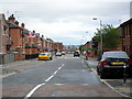
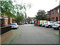
2
Berlin Street, Belfast
Like most of the Shankill this was redeveloped in the 1980s from dense terraces to more open houses as can be seen here. Berlin Street leads off the Shankill towards the Crumlin Road.
Image: © Dean Molyneaux
Taken: 26 Aug 2009
0.12 miles
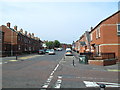
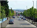
3
Riga Street, Belfast
One of many redeveloped streets in the Shankill area. It runs parallel with the Shankill Road itself.
Image: © Dean Molyneaux
Taken: 26 Aug 2009
0.12 miles
4
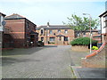
Tobergill Street, Belfast
Redeveloped in the 1980s - once ran parallel with Riga Street - now it has been made into a crescent linking Carnan Street with Riga Street.
Image: © Dean Molyneaux
Taken: 26 Aug 2009
0.13 miles
5
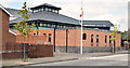
Immanuel Presbyterian church, Belfast (September 2014)
A Presbyterian church, on the western side of Agnes Street. The church’s website http://www.immanuelbelfast.co.uk/ states “The congregation was born in 1971 out of a union of Agnes Street and Bethany congregations and a further union took place in 2007 when Immanuel and Oldpark congregations amalgamated. Due to structural problems with the old church building a new meeting house was constructed on the same site. It opened on the 9th February 2008”. Not to be confused with this one Image
Image: © Albert Bridge
Taken: 10 Sep 2014
0.15 miles
6
Pernau Street, Belfast
A much redeveloped part of the Shankill. Pernau Street used be a row of 'two-up-two-down' houses running left to right where the houses are in the distance at present. It has been diverted to Riga Street.
Image: © Dean Molyneaux
Taken: 26 Aug 2009
0.15 miles
8
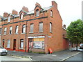
Cosy Fuels, Tennent Street, Belfast
At 114 Tennent Street - now derelict. Belfast 237333 has actually been reassigned to restaurant in Amelia Street - in the city centre.
Image: © Dean Molyneaux
Taken: 26 Aug 2009
0.16 miles
9
Plaque, Tennent Street, Belfast
Self explanatory.
Image: © Dean Molyneaux
Taken: 26 Aug 2009
0.16 miles
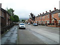
10
Riga Street, Belfast
Redeveloped in the 1980s. Looking towards Carnan Street. Riga Street once continued further to become Lower Riga Street - however a residential home now stands in the way.
Image: © Dean Molyneaux
Taken: 26 Aug 2009
0.16 miles