IMAGES TAKEN NEAR TO
Boucher Road, BELFAST, BT12 6RZ

Introduction

This page details the photographs taken nearby to Boucher Road, BT12 6RZ by members of the Geograph project.

The Geograph project started in 2005 with the aim of publishing, organising and preserving representative images for every square kilometre of Great Britain, Ireland and the Isle of Man.

There are currently over 7.5m images from over14,400 individuals and you can help contribute to the project by visiting https://www.geograph.org.uk

Image Map


Images are licensed for reuse under creativecommons.org/licenses/by-sa/2.0
Notes
  • Clicking on the map will re-center to the selected point.
  • The higher the marker number, the further away the image location is from the centre of the postcode.

Image Listing (86 Images Found)

Images are licensed for reuse under creativecommons.org/licenses/by-sa/2.0
  • ...
Image
Details
Distance
1
Pillar box, Belfast
GR pillar box near the Stockman’s Lane end of the Boucher Road Image
Image: © Albert Bridge Taken: 30 Oct 2011
0.06 miles
2
Direction sign, Stockman's Lane, Belfast (October 2014)
See Image Close by, this direction sign (opposite the Boucher Road) directs traffic towards, Shaw’s Bridge, Forestside, Knock and Tillysburn. It shows only the major destinations.
Image: © Albert Bridge Taken: 13 Oct 2014
0.08 miles
3
E-car charging point, Balmoral, Belfast (September 2014)
A car, plugged in and charging, at an e-car charging point on the Boucher Road side of the Shane Retail Park Image
Image: © Albert Bridge Taken: 4 Sep 2014
0.08 miles
4
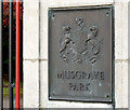
Musgrave Park gate plaque, Belfast (October 2014)
One of two similar plaques, featuring the park’s name and the Belfast coat of arms, at this entrance Image
Image: © Albert Bridge Taken: 13 Oct 2014
0.08 miles
5
Main entrance gates, Musgrave Park, Belfast (October 2014)
The main gate (not used by vehicles) at Stockman’s Lane.
Image: © Albert Bridge Taken: 13 Oct 2014
0.08 miles
6
Direction and temporary diversion signs, Stockman's Lane, Belfast (October 2014)
The green direction sign is for traffic heading towards the M1 and west and north Belfast via the outer ring. The yellow diamond (right) (normally left uncovered) is officially described as “Where, in an emergency, it is necessary to close a section of motorway or other main road to traffic, a temporary sign may advise drivers to follow a diversion route. To help drivers navigate the route, black symbols on yellow patches may be permanently displayed on existing direction signs, including motorway signs. On all‑purpose roads, the symbols may be used on separate signs with yellow backgrounds”. They are opposite the Boucher Road. See also Image
Image: © Albert Bridge Taken: 13 Oct 2014
0.09 miles
7
Stockman's Lane (old and new), Belfast
Previously a local road connecting the Lisburn and Falls Roads, Stockman’s Lane was realigned and widened on the building of the M1 Image in the 1960’s. The original line is on the right. The view is towards the M1 from the end of the Boucher Road Image Now a busy part of the Belfast outer ring road – see also Image, Image and Image
Image: © Albert Bridge Taken: 30 Oct 2011
0.09 miles
8
Autumn seat, Musgrave Park, Belfast (October 2014)
A seat, surrounded by evergreens and fallen autumn leaves, close to this Stockman’s Lane gate Image
Image: © Albert Bridge Taken: 13 Oct 2014
0.09 miles
9
Shane Retail Park, Belfast (1)
Part of the Shane Retail Park, fronting the Boucher Road. Built on the site of Shane Park, formerly the grounds of Instonians Image rugby, hockey and cricket club. See also Image
Image: © Albert Bridge Taken: 30 Oct 2011
0.10 miles
10
Seat, Musgrave Park, Belfast (October 2014)
One of the many seats in the park.
Image: © Albert Bridge Taken: 13 Oct 2014
0.10 miles
  • ...