1
Freight train leaving Adelaide yard
An Irish Rail 141 class locomotive pulls a train of containers and cement "bubbles" out of Adelaide freight yard. This yard closed at the end of 2000 and there is now no rail freight traffic of any kind to Belfast.
Image: © The Carlisle Kid
Taken: 28 Mar 1992
0.10 miles
2
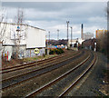
Railway near Adelaide, Belfast
Looking along the railway line towards Adelaide depot and central Belfast beyond. The middle and right hand tracks are used by passenger trains while the left hand line runs into the depot at Adelaide.
Image: © Rossographer
Taken: 6 Mar 2008
0.11 miles
3
Moonstone Street, Belfast [1]
More terraced housing on the north side of the Lisburn Road, this is Moonstone Street.
Image: © Rossographer
Taken: 15 Apr 2008
0.11 miles
4
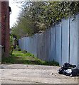
Alley, Belfast
Alley running along part of the rear Moonstone Street in Belfast. The railway line is over the fence to the right.
Image: © Rossographer
Taken: 15 Apr 2008
0.11 miles
5
New train maintenance depot, Belfast (15)
Ideally I would have liked to include a photograph from the Lislea Avenue/Lislea Drive footbridge but other buildings obstruct the view. This one shows the depot, under construction, behind Charleville Street
Image The Google map and the satellite photograph do not coincide.
Image: © Albert Bridge
Taken: 8 Nov 2011
0.11 miles
6
Moonstone Street, Belfast [2]
The weathered old street sign at the end of Moonstone Street.
Image: © Rossographer
Taken: 15 Apr 2008
0.12 miles
7
Entry, Belfast
Entry between Moonstone Street http://www.geograph.org.uk/search.php?i=10097122 and the Lisburn Road in Belfast. Taken during the cold spell in early 2010.
Image: © Rossographer
Taken: 7 Jan 2010
0.12 miles
8
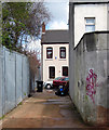
Alley, Charleville Street, Belfast
An alley running off Charleville Street (facing) in Belfast. The railway line is over the fence to the left.
Image: © Rossographer
Taken: 15 Apr 2008
0.12 miles
9
Hairdresser, Lisburn Road, Belfast
A very interesting shopfront on an old terrace composed of bricks laid at 45 degree angles with a steel framed window on the first floor. The door at ground level looks like it was inspired by a prison cell.
I absolutely hate it.
Image: © Rossographer
Taken: 6 Mar 2008
0.12 miles
10
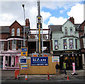
Construction, Lisburn Road, Belfast
Part of the terrace has been demolished and a new structure is in the process of being constructed.
Image: © Rossographer
Taken: 15 Apr 2008
0.12 miles


![Moonstone Street, Belfast [1]](https://s2.geograph.org.uk/photos/76/42/764282_2dc882c7_120x120.jpg)


![Moonstone Street, Belfast [2]](https://s2.geograph.org.uk/photos/76/42/764286_754a4220_120x120.jpg)


