1
Soudan Street, Belfast
A street of terraced houses leading south from the Donegall Road in Belfast 12. View towards the Donegall Road/Rydalmere Street junction.
Image: © Dean Molyneaux
Taken: 29 Apr 2011
0.03 miles
2
Nos 296-298 Donegall Road, Belfast - June 2016(1)
A long-term vacant property, now semi-derelict, at the corner of Kitchener Street – another of sites for which I have not been able to find any application for planning permission for redevelopment.
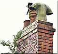
Image shows the chimney.
Image: © Albert Bridge
Taken: 7 Jun 2016
0.04 miles
3
Nos 296-298 Donegall Road, Belfast - June 2016(2)
See
Image A chimney with three pots - one fairly standard with a raised ring at the top, one louvred and one with a curved “H” top (my description).
Image: © Albert Bridge
Taken: 7 Jun 2016
0.04 miles
4
Young Citizens Volunteers mural, Belfast
A mural at Kitchener Drive (Kitchener Street on the Google map) commemorating the Young Citizens Volunteers (YCV) http://en.wikipedia.org/wiki/Young_Citizen_Volunteers_(1912).
Image: © Albert Bridge
Taken: 30 Jan 2014
0.04 miles
5
New houses, The Village, Belfast - February 2015(1)
Redevelopment of The Village continuing along Kitchener Drive (Kitchener Street on the Google map), between Soudan Street and Broadway Parade. For reference purposes Kitchener Street is at bottom right.
Image: © Albert Bridge
Taken: 23 Feb 2015
0.04 miles
6
Donegall Road gospel hall, Belfast
A gospel hall, at the corner of Rydalmere Street, built between 1901 and 1907.
Image: © Albert Bridge
Taken: 8 Feb 2014
0.04 miles
7
Kitchener Drive, Belfast - January 2014
The view, west, along Kitchener Drive (Kitchener Street on the Google map) towards Ebor Street. With one small exception all the streets on the south (left) have been demolished. “The Rise” sculpture http://www.geograph.org.uk/snippet/5211 and Broadway Towers
Image are in the background.
Image: © Albert Bridge
Taken: 30 Jan 2014
0.05 miles
8
Royal Wedding celebrations, Donegall Road, Belfast
This event, which closed the busy thoroughfare from Rockview Street to Donegall Avenue, was one of several similar events taking place across the city to celebrate the marriage of Prince William, the Duke of Cambridge and Kate Middleton on April 29, 2011. The ceremony was still underway when the photograph was taken, which perhaps explains why the crowd was not big.
Image: © Dean Molyneaux
Taken: 29 Apr 2011
0.06 miles
9
Renovation work, Donegall Avenue, Belfast (July 2014)
Renovation work now underway on this property
Image (January 2014) at the corner of Kitchener Drive.
Image is on the left.
Image: © Albert Bridge
Taken: 27 Jul 2014
0.06 miles
10
No 2 Empire Street, Belfast (June 2016)
A disused single-storey former shop beside the Ulidia
Image (right). The 1960 street directory shows it occupied by Kennedy Crossett, grocer.
Image: © Albert Bridge
Taken: 7 Jun 2016
0.06 miles


