
IMAGES TAKEN NEAR TO
St. Georges Gardens, BELFAST, BT12 5FJ
Introduction
This page details the photographs taken nearby to St. Georges Gardens, BT12 5FJ by members of the Geograph project.
The Geograph project started in 2005 with the aim of publishing, organising and preserving representative images for every square kilometre of Great Britain, Ireland and the Isle of Man.

There are currently over 7.5m images from over14,400 individuals and you can help contribute to the project by visiting https://www.geograph.org.uk
Image Map
Images are licensed for reuse under creativecommons.org/licenses/by-sa/2.0
Notes
- Clicking on the map will re-center to the selected point.
- The higher the marker number, the further away the image location is from the centre of the postcode.
Image Listing (1264 Images Found)
Images are licensed for reuse under creativecommons.org/licenses/by-sa/2.0
Image
Details
Distance
1
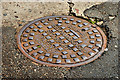
"Grip-Fix" manhole cover, Belfast
“Grip-Fix” cover, from the foundry of J Needham & Sons Limited, Stockport, at the Sandy Row end of Maxwell Street. Image shows another one – on the Castlereagh Road.
Image: © Albert Bridge
Taken: 11 Aug 2010
0.03 miles
2

Albion Street, Belfast
The former Albion Street ran from Gt Victoria Street Image to Sandy Row. The present version is a cul-de-sac off Sandy Row (background).
Image: © Albert Bridge
Taken: 24 May 2009
0.03 miles
3

Albion Street housing site, Belfast (6)
New houses nearing completion at the Sandy Row end of St George’s Gardens (Albion Street on the Google map).
Image: © Albert Bridge
Taken: 9 Sep 2012
0.04 miles
4

The Stroud Street Murals, Belfast
Walking around Belfast now, although you feel quite safe, the Unionist and Republican areas still have their distinctive murals and panels so there is never any doubt which area you are in. These murals are in Stroud Street which is between Sandy Row and Donegall Pass which is a Protestant/Unionist area. The murals are more general rather than political and are of Old History & Sporting Heroes of Belfast. See also www.geograph.org.uk/photo/7885473
Image: © Marathon
Taken: 14 Aug 2024
0.04 miles
5
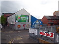
George Best mural
At the junction of Blythe Street and Sandy Row.
Image: © Rod Allday
Taken: 24 Apr 2011
0.04 miles
6
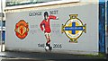
George Best mural, Belfast
Image: © Albert Bridge
Taken: 22 Feb 2009
0.04 miles
7

Tram workers mural, Belfast (February 2015)
There is a long mural at Stroud Street depicting scenes and people from the immediate area. This part, opposite Combermere Street Image, shows workers in the old Belfast Corporation tram depot. The depot was between Gaffiken Street and Napier Street.
Image: © Albert Bridge
Taken: 1 Feb 2015
0.04 miles
8

The Stroud Street Murals, Belfast
Walking around Belfast now, although you feel quite safe, the Unionist and Republican areas still have their distinctive murals and panels so there is never any doubt which area you are in. These murals are in Stroud Street which is between Sandy Row and Donegall Pass which is a Protestant/Unionist area. The murals are more general rather than political and are of Old History & Sporting Heroes of Belfast. See also www.geograph.org.uk/photo/7885469
Image: © Marathon
Taken: 14 Aug 2024
0.04 miles
9
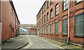
Maxwell's Place, Belfast
Maxwell’s Place runs off Maxwell Street Image 100 years ago it had Miller, Son & Torrance Ltd, collar, cuff & shirt manufacturers Image, in the building on the right and Eves & Co who also made shirts and collars.
Image: © Albert Bridge
Taken: 30 Aug 2009
0.04 miles
10

Albion Street housing site, Belfast (3)
The first of the new houses starting to appear beside the existing houses in St George's Gardens.
Image: © Albert Bridge
Taken: 27 Nov 2011
0.04 miles