
IMAGES TAKEN NEAR TO
Lisfaddan Place, BELFAST, BT12 4SJ
Introduction
This page details the photographs taken nearby to Lisfaddan Place, BT12 4SJ by members of the Geograph project.
The Geograph project started in 2005 with the aim of publishing, organising and preserving representative images for every square kilometre of Great Britain, Ireland and the Isle of Man.

There are currently over 7.5m images from over14,400 individuals and you can help contribute to the project by visiting https://www.geograph.org.uk
Image Map
Images are licensed for reuse under creativecommons.org/licenses/by-sa/2.0
Notes
- Clicking on the map will re-center to the selected point.
- The higher the marker number, the further away the image location is from the centre of the postcode.
Image Listing (218 Images Found)
Images are licensed for reuse under creativecommons.org/licenses/by-sa/2.0
Image
Details
Distance
1
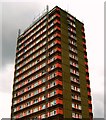
Divis Tower, Belfast
Divis Tower is a 61m (200.08 feet) tall residential tower block at the foot of the Falls Road in Belfast. 20 floors tall, it was built in 1966 and is named after the nearby Divis Mountain.
As a result of terrorist activity in the area, the British Army constructed an observation post on the roof in the 1970s and occupied the top two floors of the building. At the height of The Troubles the army was only able to access the post by helicopter. This was finally removed a few years ago.
Image: © Rossographer
Taken: 8 Aug 2007
0.06 miles
2
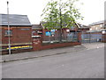
Divis Community Centre in Ardmoulin Place
Image: © Eric Jones
Taken: 20 May 2012
0.06 miles
3
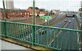
The Westlink, Belfast (10)
The view, towards the Divis Street off-slip, from the footbridge Image near Durham Street. Continue to Image
Image: © Albert Bridge
Taken: 13 Dec 2009
0.07 miles
4
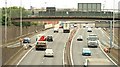
The Westlink, Belfast
See Image The Westlink (looking towards the M1) at the Divis Street flyover. There is a lane gain here where the on-slip (left) joins the road. In practice, however, few drivers use the inside lane.
Image: © Albert Bridge
Taken: 19 Aug 2009
0.07 miles
5
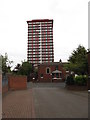
Ardmoulin Place with the Divis Tower in the background
Ardmoulin Place is situated in the back of St Peter's Cathedral.
Image: © Eric Jones
Taken: 20 May 2012
0.07 miles
6
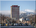
Divis, Belfast
Divis Street, Divis Tower and, in the background, a snow covered Divis Mountain in Belfast.
Image: © Rossographer
Taken: 19 Jan 2023
0.07 miles
7
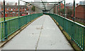
Footbridge, Westlink, Belfast (3)
See Image This footbridge connects the Cullingtree Road to Durham Street (background). Continue to Image
Image: © Albert Bridge
Taken: 13 Dec 2009
0.08 miles
8
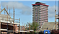
Divis Tower, Belfast (June 2017)
Some 50 years and many changes in the design of social housing separate Divis Tower and the new terraced houses now under construction at Albert Street Image (foreground).
Image: © Albert Bridge
Taken: 18 Jun 2017
0.08 miles
9
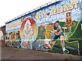
Welcome to Belfast mural on the power house of the Divis Tower
This is a quite recent addition to Belfast's murals.
Image: © Eric Jones
Taken: 20 May 2012
0.08 miles
10
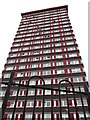
Divis Tower - multi-storey flats on Divis Street
This major landmark stands overlooking the Westlink. Built in 1966 as part of a complex of towers, it is the only one to have survived. A British Army OP was sited on its roof during The Troubles.
http://www.iguidez.com/video/guides/belfast/divis-tower/
Image: © Eric Jones
Taken: 20 May 2012
0.08 miles