1
Garron Crescent, Finaghy, Belfast (April 2016)
Pre-1960 social housing – possibly built by the old Northern Ireland Housing Trust (further information welcome). This view is from Benmore Drive towards Locksley Park.
Image: © Albert Bridge
Taken: 13 Apr 2016
0.04 miles
2
Telephone box, Finaghy, Belfast
A telephone box at Benmore Drive, at the entrance to Taughmonagh.
Image: © Albert Bridge
Taken: 4 Jul 2013
0.05 miles
3
Recycling bins, Finaghy, Belfast
Recycling bins for glass at Benmore Drive, at the entrance to Taughmonagh.
Image: © Albert Bridge
Taken: 4 Jul 2013
0.05 miles
4
The Cooke Memorial Hall, Finaghy, Belfast
A disused church hall, at Benmore Drive, Taughmonagh, named after this gentleman
Image, for which there is the following application for planning permission “Z/2013/0297/F Change of use from church hall to use class B1 light industrial”.
Image: © Albert Bridge
Taken: 4 Jul 2013
0.06 miles
5
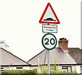
20mph speed limit sign, Finaghy, Belfast (May 2016)
Green-bordered 20mph advisory speed limit sign at the Finaghy Road South end of Hillmount Gardens.
Image: © Albert Bridge
Taken: 1 May 2016
0.10 miles
6
Moylena House, Finaghy, Belfast
One of two adjacent and identical tower blocks, in the Taughmonagh estate
Image, built for the Northern Ireland Housing Trust in the early 1960’s. The view is from Orpen Park, Finaghy Road South. See also
Image
Image: © Albert Bridge
Taken: 6 Jul 2011
0.12 miles
7
Pillar box, Finaghy, Belfast
Drop box and EIIR pillar box, at the corner of Erinvale Avenue and Finaghy Road South.
Image: © Albert Bridge
Taken: 6 Jul 2011
0.12 miles
8
Erinvale bus, Belfast (3)
Erinvale is the terminus for two Metro services to the city centre via the Malone Road. The 8A
Image which runs via the Stranmillis Road and the 8B
Image which avoids the Stranmillis Road. This is a Wrightbus Solar-bodied Scania, awaiting departure from the terminus at Erinvale Avenue with 10.52 8B to Wellington Place.
Image: © Albert Bridge
Taken: 6 Jul 2011
0.12 miles
9
Ely Manor, Finaghy, Belfast - May 2016(1)
See
Image New apartments now under construction. The agents’ website describes them as “A stunning selection of luxury two bedroom apartments.” This photograph appears as a matter of record only. I have no connection with any of the parties involved in the development. Continue to
Image
Image: © Albert Bridge
Taken: 1 May 2016
0.13 miles
10
Ely Manor, Finaghy, Belfast - May 2016(2)
See
Image The agents’ board with the architect’s impression of the completed apartments.
Image: © Albert Bridge
Taken: 1 May 2016
0.13 miles


