IMAGES TAKEN NEAR TO
Newcombe Drive, BRISTOL, BS9 1SR
Introduction
This page details the photographs taken nearby to Newcombe Drive, BS9 1SR by members of the Geograph project.
The Geograph project started in 2005 with the aim of publishing, organising and preserving representative images for every square kilometre of Great Britain, Ireland and the Isle of Man.

There are currently over 7.5m images from over14,400 individuals and you can help contribute to the project by visiting https://www.geograph.org.uk
Image Map
Images are licensed for reuse under creativecommons.org/licenses/by-sa/2.0
Notes
- Clicking on the map will re-center to the selected point.
- The higher the marker number, the further away the image location is from the centre of the postcode.
Image Listing (129 Images Found)
Images are licensed for reuse under creativecommons.org/licenses/by-sa/2.0
Image
Details
Distance
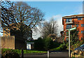
1
Green, Branscombe Road, Sea Mills
A grass triangle at the junction of Branscombe Road with Roman Way (right).
Image: © Derek Harper
Taken: 29 Mar 2014
0.06 miles
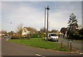
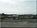
2
A4 Portway at Sea Mills
Looking towards Avonmouth.
Image: © Jonathan Billinger
Taken: 13 Sep 2016
0.11 miles
3
Remains of Roman Dwelling at Portus Abonae (Sea Mills)
Portus Abonae was an ancient Roman Settlement at Sea Mills, where the Roman army would await embarkation for Caerleon, Wales. The photo is apparently of remains of dwellings which formed part of a military fort in Claudian times. It is taken between Roman Way and the Portway, facing due South. Most commuters speeding down the Portway would never know it was there!
Image: © David Dring
Taken: 19 Jan 2006
0.12 miles
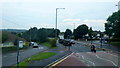
4
Portway, Sea Mills
Looking along the A4 Portway towards central Bristol, just east of the River Trym.
Image: © Stephen McKay
Taken: 10 Nov 2010
0.12 miles
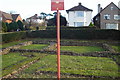
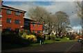
5
Flats, Glenavon Park
Westonian Court (left) and Glenavon Court, seen from the path that leads down to Old Sneed Park Nature reserve, as the signpost aays.
Image: © Derek Harper
Taken: 28 Dec 2021
0.12 miles
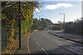
6
Glenavon Park
A curving road in Sneyd Park. On the left are flats at Glenavon Court.
Image: © Derek Harper
Taken: 28 Dec 2021
0.12 miles
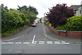
7
Bristol : Hadrian Close
Looking towards bungalows on Hadrian Close from Portway A4.
Image: © Lewis Clarke
Taken: 30 May 2015
0.13 miles
8
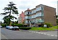
Newbridge House, Sea Mills Lane, Bristol
Newbridge House is a block of six flats, on the east side of the Portway bridge http://www.geograph.org.uk/photo/3023246 over the River Trym.
Image: © Jaggery
Taken: 23 Jun 2012
0.13 miles
9
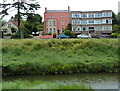
Housing variety, Sea Mills Lane, Bristol
Viewed across the River Trym. Newbridge House flats are on the right. http://www.geograph.org.uk/photo/3028870
Attached to the flats is a 3-storey late Georgian house, built in 1812.
Image: © Jaggery
Taken: 23 Jun 2012
0.13 miles
10
Abbeywood Drive, Sea Mills, Bristol
Viewed across Sea Mills Lane. Abbeywood Drive is a cul-de-sac. Its far end is aligned at 90 degrees to the nearer section.
Image: © Jaggery
Taken: 23 Jun 2012
0.13 miles